


BOZEMAN – The next couple of days will be mostly dry and mild and travel weather looks favorable for most of Montana with the exception of gusty winds in wind prone areas. However, a significant weather pattern change is coming to Montana beginning Sunday.
SEVERE WINTER WEATHER BRIEFING:
The Great Falls National Weather Service held a webinar Thursday with details of a possible severe winter storm Sunday through Wednesday.
The combination of colder Arctic air dropping down into Montana Sunday and increasing snow showers Sunday through Tuesday will produce the coldest temperatures of the winter season so far and could produce areas of heavy snow impacting travel.
In the next day or two NWS will issue a Winter Storm Watch and as we get closer to the pattern change look for either advisories or warnings to replace the watch.
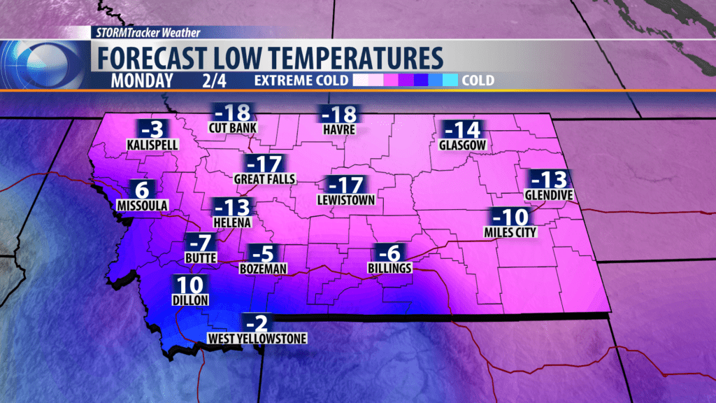
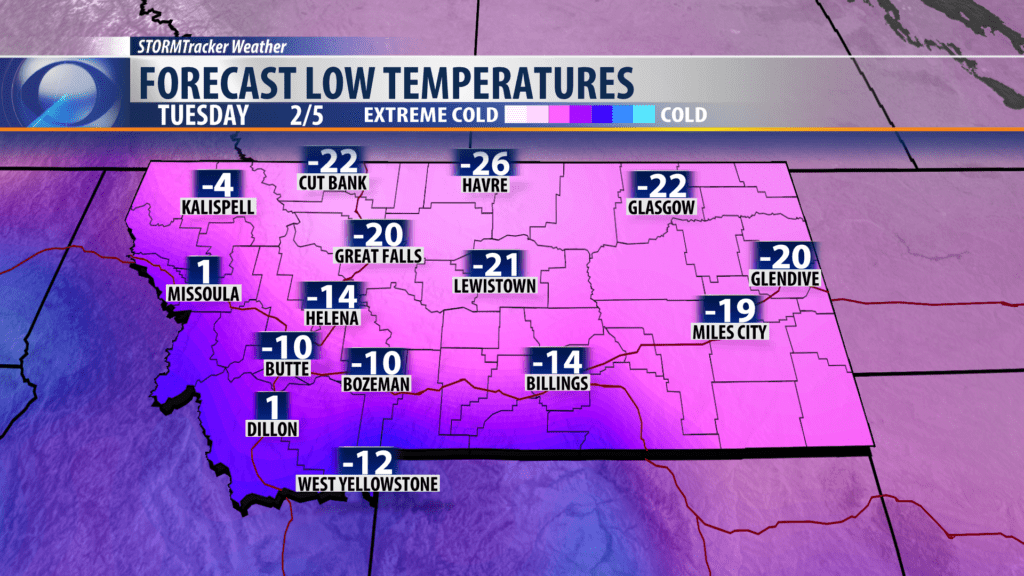
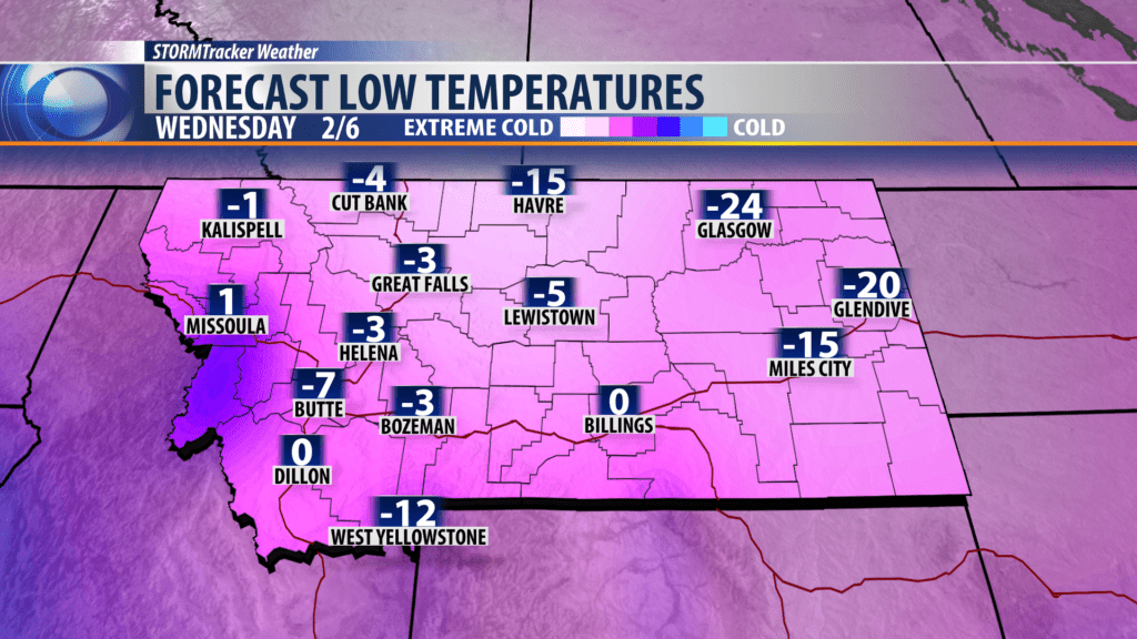
Northern and central counties of Montana will likely experience the coldest air temperatures and dangerous wind chills Monday through Wednesday of next week. Forecast lows could drop between -15° to -30° for Northern and central Montana.
Far western and SW Montana will experience much colder temperatures but the extremely cold air may not make it to Dillon or Missoula (this could change).
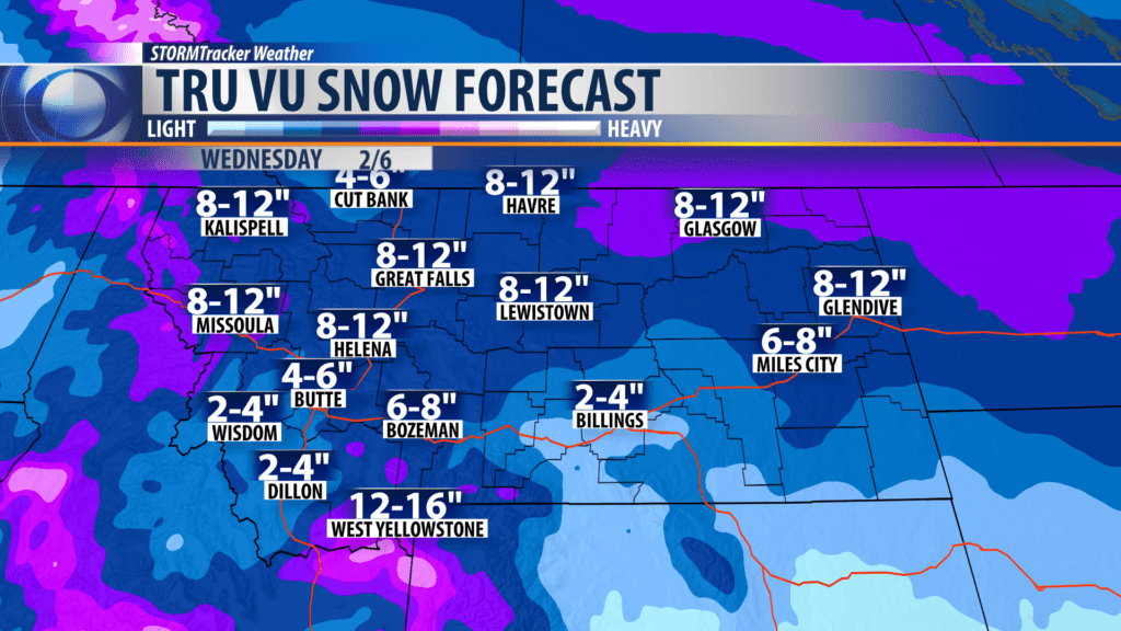
NWS estimates of possible snow totals (this will likely change) of 3″-6″ for Bozeman, 8″-12″ for Helena, Dillon 2″-4″, Great Falls 6″-8″, Lewistown 6″-8″, West Yellowstone 4″-8″ and Butte 3″-4″.
Again the combination of Arctic air, below zero air temperatures, dangerously low wind chills and areas of moderate to heavy snow is possible across Montana in the first 10 to 15 days of February.
Supporting graphics: (model forecast data below, actual forecast may vary)
City by City Forecast:
BOZEMAN: LOW: 20°; HIGH FRIDAY: 42°. Clearing later and chilly by Friday morning. Friday sunny early with increasing clouds by afternoon and light winds.
BUTTE: LOW: 14°; HIGH FRIDAY: 39°. Partly cloudy tonight and Friday with light winds.
DILLON: LOW: 18°; HIGH FRIDAY: 41°. Partly cloudy with light winds tonight into Friday. Chilly in the morning and mild by late afternoon.
WEST YELLOWSTONE: LOW: 0°; HIGH FRIDAY: 32°. Look for partial clearing overnight and colder by early morning with lows down around zero or even slightly below. Partly cloudy and mild by late afternoon.
