


BOZEMAN – Next weather maker is off the California coast Friday afternoon and will follow the jet stream up into the pacific NW and Northern Rockies Saturday night through Monday morning.
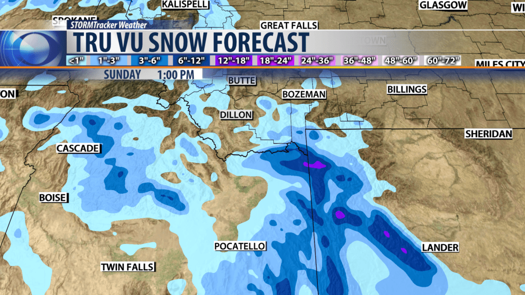
Greatest concerns for traveling will be mountain passes along the MT/ID state line with snow and wind for Monida Pass on I-15 and secondary highways from West Yellowstone to Idaho Falls, ID. Island Park, ID for example could see moderate snow accumulations as well as Yellowstone National Park Sunday into Monday.
City by City Forecast:
BOZEMAN: LOW: 18°; HIGH SATURDAY: 40°. Cloudy to partly cloudy tonight and Saturday. Cool overnight but mild by Saturday afternoon. Surface winds should be light through Saturday afternoon and increase Saturday evening into Sunday.
BUTTE: LOW: 13°; HIGH SATURDAY: 36°. Mostly cloudy tonight and again on Saturday. Chilly Saturday morning and mild by afternoon as surface winds increase ahead of the next storm 10-20 mph out of the SW.
DILLON: LOW: 19°; HIGH SATURDAY: 40°. Partly cloudy to cloudy through Saturday afternoon. Chilly overnight but mild by afternoon. Surface winds will increase ahead of the next storm Saturday afternoon with 10-20 mph sustained winds likely but stronger gusts are possible for Monida and Big Hole passes.
WEST YELLOWSTONE: LOW: 8°; HIGH SATURDAY: 32°. Cloudy and cool tonight and Saturday. Light winds until the next weather maker arrives late Saturday. Snow accumulations are likely Sunday into Monday with 2″ – 4″ possible and over 6″ through Island Park, ID.
