


BOZEMAN, Mont.- Strong surface winds will continue across Montana heading into tonight. Locally, SW Montana could peak wind gusts around 50+ mph mostly in high wind prone areas like: Whitehall, Three Forks, Norris Hill and Ennis, Warm Springs to Deer Lodge and of course Livingston.
The rest of SW Montana will experience gusty winds through at least midnight but should diminish overnight.
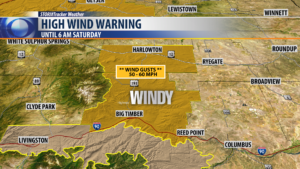
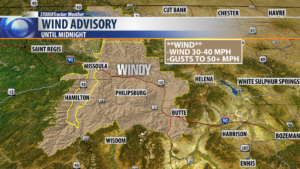
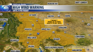
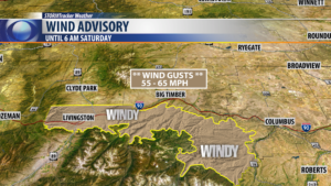
The National Weather Service has a variety of High Wind Warnings and Wind Advisories up in our region. See graphics below:
City by City Forecast:
BOZEMAN: LOW: 32°; HIGH SATURDAY: 43°. Strong winds likely into tonight with gusts over 30 mph at times. A few valley rain or snow are possible but area mountains above 5,000′ could see moderate snow accumulations overnight. Cooler Saturday and cloudy with only a few showers and mountain snow and not as windy.
BUTTE: LOW: 31°; HIGH SATURDAY: 44°. Strong winds will continue for Butte and surrounding areas through midnight with peak gusts over 30 mph. Scattered rain or snow is possible as well with scattered mountain snow above 5,000′. Saturday will be cooler and not as windy. Scattered rain or snow is possible and likely to increase again Saturday evening into Sunday.
DILLON: LOW: 30°; HIGH SATURDAY: 45°. Strong winds will continue across Beaverhead county through midnight. Scattered mainly mountain snow is possible with several inches of snow at higher elevations. Saturday will be mostly cloudy with a few showers and mountain snow but not as windy.
WEST YELLOWSTONE: LOW: 24°; HIGH SATURDAY: 38°. Scattered mostly snow showers and gusty winds to continue for West Yellowstone into tonight. Cooler overnight and Saturday. Mostly cloudy with a few passing snow showers Saturday.
