


BOZEMAN – Warm and windy for SW Montana through Friday. Temperatures should remain above to well above normal through next week. Daytime highs and morning lows could be 10 to 20 degrees above normal.
High Wind Warning continues for SW Montana east of the divide through 11 pm Wednesday. Peak gusts up to or over 60 mph are possible in the warning areas.
Windy conditions are likely to persist Thursday and Friday and this could bring a slightly higher risk for grassland wildfires so please be careful down in the lower valleys.
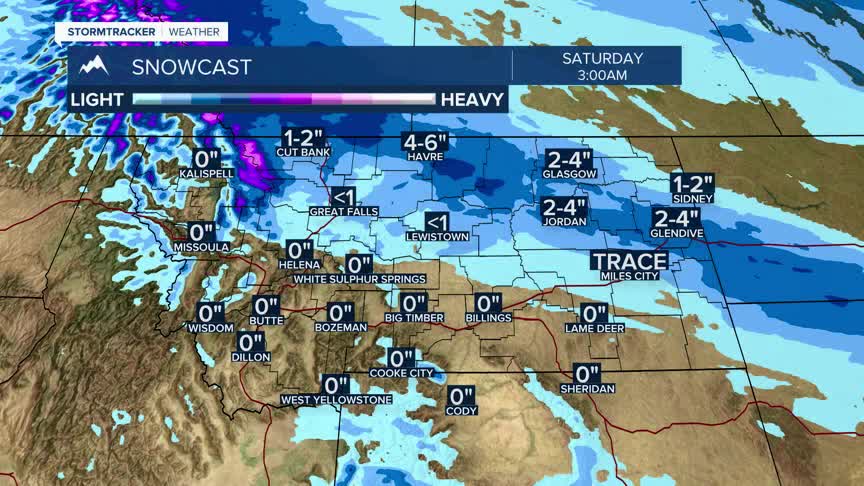
An arctic front will clip northern and eastern Montana by Friday night into Saturday. This cold front will produce scattered snow showers from Cut Bank to Miles City north of that line.
Temperatures could be slightly cooler this weekend because of the Arctic air in northern Montana but remain above normal locally.
