BOZEMAN – Increasing scattered thunderstorms will be the dominate weather pattern for the next 3 to 4 days as a steady stream of monsoon moisture pushes in from the South.

Most thunderstorms will develop in the late afternoon through early evening, however, there could also be a few overnight thunderstorms through Saturday.
Temperatures will be slightly cooler with increased cloud cover during the day, but overnight temperatures will be warmer due to the mostly cloudy skies.
The other threat with this pattern is lightning and new fires start. Some thunderstorms could produce brief heavy rainfall but with the very dry vegetation even with rainfall new fires are possible over the next few days. Afternoon thunderstorms will also produce gusty outflow wind gusts which are erratic and could cause existing fires to grow more aggressively through the weekend.
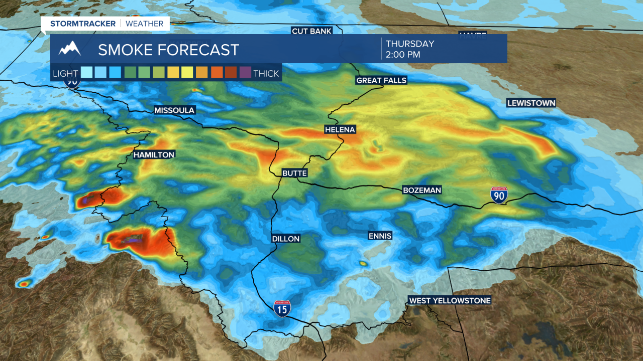
Increasing wildfire smoke will also likely push back over SW Montana mostly from the Moose Fire north of Salmon, ID but there are several smaller fires in central Idaho that could contribute to increasing wildfire smoke. At times, the smoke could be very thick and air quality conditions would deteriorate.