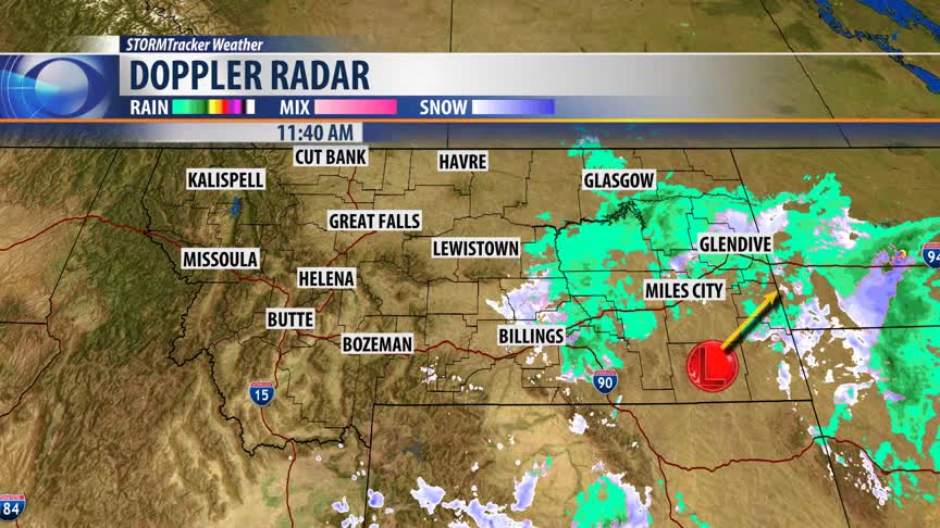


BOZEMAN - Finally starting to see a slow moving Low-pressure system passing out of Montana today. The upper-level Low is impacting eastern counties with scattered rain and snow but will roll up into North Dakota tonight. Travel impacts will continue with areas of light snow heading into northern Wyoming and into North Dakota through midnight.
WINTER WEATHER ADVISORY
Areas of light snow and cold temperatures will bring wintry travel impacts to far eastern Montana through midnight. The National Weather Service has a Winter Weather Advisory up for this region. If you are traveling into eastern Wyoming or South and North Dakota look for snow and wind impacting travel.
NEXT WEATHER MAKER
Weak High pressure is building into western Montana tonight producing clearing skies and that should produce a hard freeze tonight as Thursday morning lows fall into the teens and 20s. A few near record lows are possible Thursday morning. The good news in the weather forecast is temperatures will be warming up by Thursday afternoon ahead of the next pacific cold front.
Friday this next weather maker will bring another shot of rain or snow to SW Montana with accumulating snow likely for most mountains and passes. This system should pass through quickly and could be gone by Friday evening. I'll have updates on the timing of this storm front and impacts tonight at 5:30 pm and 10 pm on KBZK and KXLF.
