


BOZEMAN – Today's quiet weather pattern ends Saturday morning. In fact, a very active weather pattern begins Saturday morning and continues through the end of next week with periods of snow, wind, and much colder temperatures.
If you have travel plans please check in with your STORMTracker weather team frequently for updates as there will likely be several round of winter weather highlights issued across the state.
The first wave of moisture arrives Friday night into Saturday morning with the greatest travel impacts over NW and far western Montana into central Idaho.
The National Weather Service has issued a WINTER WEATHER ADVISORY Friday night into Saturday morning with accumulating snow creating difficult to hazardous travel conditions including I-90 from Missoula to Lookout Pass.

There are no winter weather highlights out for SW Montana with this first round of snow but light snow is likely over all mountain passes across SW Montana. Lower valleys could see some light snow as well with most forecast models showing an inch or less.

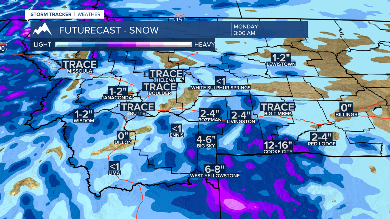
The next round of snow arrives Sunday afternoon through Monday. A stronger northerly flow aloft will develop late weekend. This will pave the way for more off and on snow showers throughout most of next week and open the door for Arctic air to drop southward.
Morning lows could fall below zero across Montana by Tuesday morning. Overall, temperatures will remain below to well below normal this weekend through next weekend.
