


BOZEMAN – A long duration Atmospheric River continues to produce active weather conditions over the region through the weekend.
Mountain snow, heavy at times, is possible through Saturday evening and that includes several local mountain passes like: Homestake Pass, Bozeman Pass, Boulder Hill, Elk Park, and MacDonald Pass.
Winter Storm Warnings remain in place through noon Saturday west of the divide and through 6 pm Saturday east of the divide for SW Montana.
The National Weather Service also issued a new HIGH WIND WARNING for SW Montana east of the divide from noon to 9 pm Saturday. Sustained wind30 to 40 mph and peak gusts up to 60 mph are possible across Beaverhead, Madison, Gallatin, Jefferson, and Broadwater counties.
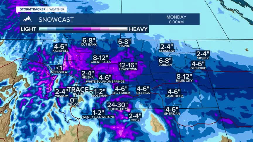
Cooler temperatures will arrive Sunday along with a weak disturbance Sunday night into Monday morning. This could produce some areas of snow into Monday morning.
A building High pressure ridge will begin to take a foothold over the region beginning Tuesday with a substantial warming trend by the middle to end of next week.
