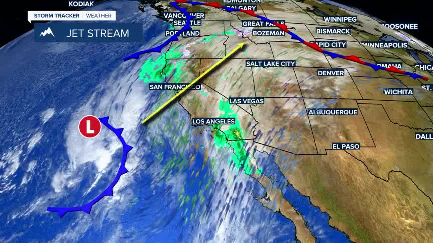


BOZEMAN – Another warm core Pacific storm off the southern California coast will begin to lift to the NE Wednesday and reach SW Montana Wednesday evening into Thursday.
There is a good chance for valley rain and mountain snow across SW Montana Wednesday night into early Thursday morning. This storm will bring heavy wet snow for mountain passes with slush covered roads and possible icing at higher elevations.
Right now, the forecast has mostly valley rain Wednesday night into Thursday morning. However, anytime when rain is in the forecast this time of the year there is always a chance for pockets of freezing rain.
Freezing rain is likely across central and eastern Montana Wednesday night into Thursday morning from Great Falls to Lewistown to Miles City and Glendive. This could have a significant impact on travel conditions in those regions.
Conditions should improve by Thursday afternoon. Friday look for a little more scattered rain or snow to impact SW Montana.
Temperatures will remain well above normal through the end of the week with cooler temperatures arriving for a brief time this weekend.
