


BOZEMAN – A high wind event will impact the entire state of Montana Tuesday evening through Wednesday evening.
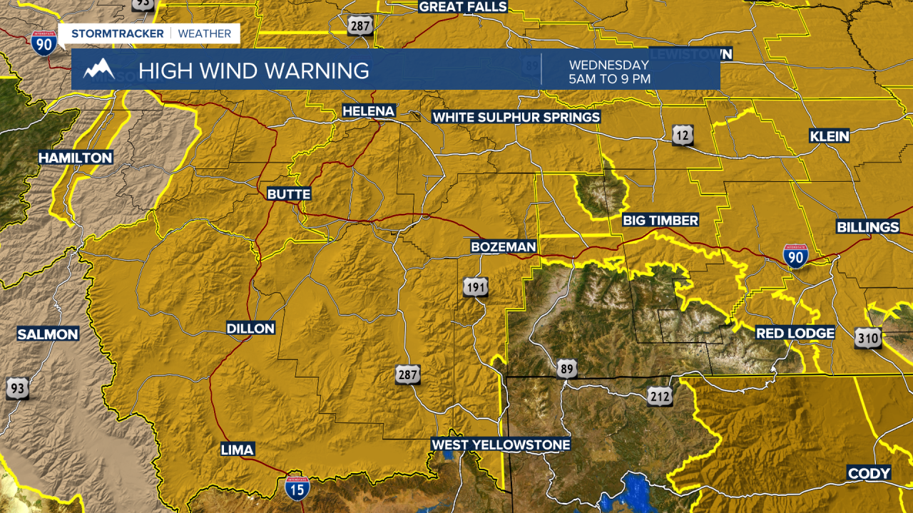
It’s rare to see the entire state of Montana under a HIGH WIND WARNING Wednesday. Damaging wind gusts are possible with peak gusts over 60 mph. Locally, high wind prone areas could see peak gusts between 65 and 75 mph.
SW Montana is under a HIGH WIND WARNING from 5 am Wednesday through 9 pm Wednesday. Sustained West winds 25 to 45 mph and gusts over 60 mph are possible.
Impacts: Blown down trees and power outages. Travel will be very difficult especially for high profile vehicles.
MDT has closed I-90 near Livingston as of Tuesday morning and traffic is detoured through Livingston to bypass a dangerous crosswind area on I-90.

A powerful Pacific storm is slowly digging into the Pacific NW today and will slide across Montana Wednesday. A warm front is producing much warmer temperatures Tuesday but a cold front will pass through the region Wednesday morning.

That cold front will be the focal point for strong wind gusts, valley rain, and higher mountain snow. It will take most of the day Wednesday for strong wind gusts to subside with damaging gusts ending around midnight Wednesday.
