


BOZEMAN – Please stay in the weather loop this week as Montana will see a pattern change later in the week with colder than normal temperatures.
Short-term forecast is just the opposite of the longer-range forecast. A new Pacific storm is off the NW coast and a High-pressure ridge is parked over the central Rockies. This combination is producing a milder SW flow aloft and pushing temperatures slightly higher than normal through Tuesday.
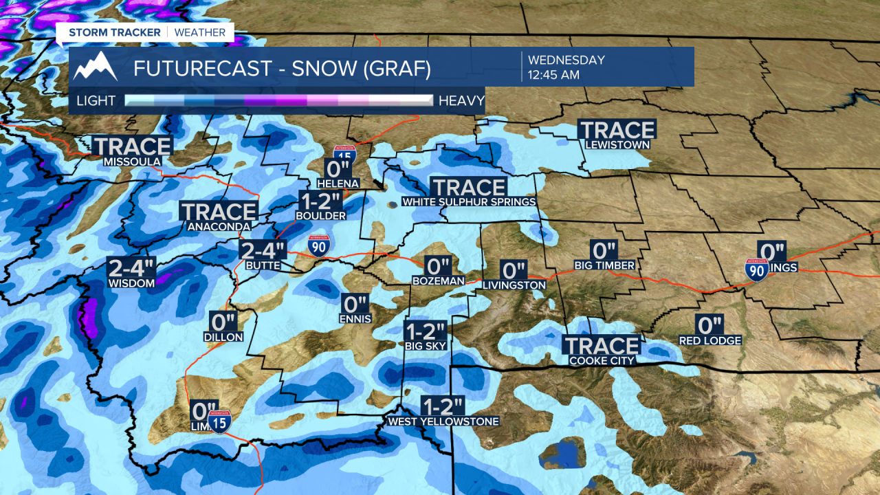
A cold front will bring increasing areas of snow by Tuesday afternoon into Wednesday morning. In fact, some lower valleys could see rain changing to snow Tuesday afternoon and evening and that could produce very icy road conditions Tuesday night into Wednesday morning. Plan on a slow go and icy Wednesday morning and evening commute to work.
As mentioned above a pattern change begins Thursday as a High-pressure ridge will build off the Pacific NW coast producing a stronger Northerly flow aloft for Montana. This will open the door for several rounds of colder Canadian air with a hint of Arctic air to drop down into Montana and much of the northern plains and Great Lakes region.
The core of the coldest air should remain well east of SW Montana but plan on colder temperatures and possibly some snow later this week and for the first weekend of February.
6 to 10 outlook from the Climate Prediction Center is giving Montana a 60% to 70% chance of colder than normal temperatures February 6 to the 10th. Precipitation trends during the same time period shows below normal precipitation across the Pacific NW, near normal for most of western Montana and only slight above normal for the eastern half of Montana.


Will we fall below zero? That is the question we will try and answer in my extended forecast tonight at 5:30 pm and 10 pm on KXLF and KBZK.
