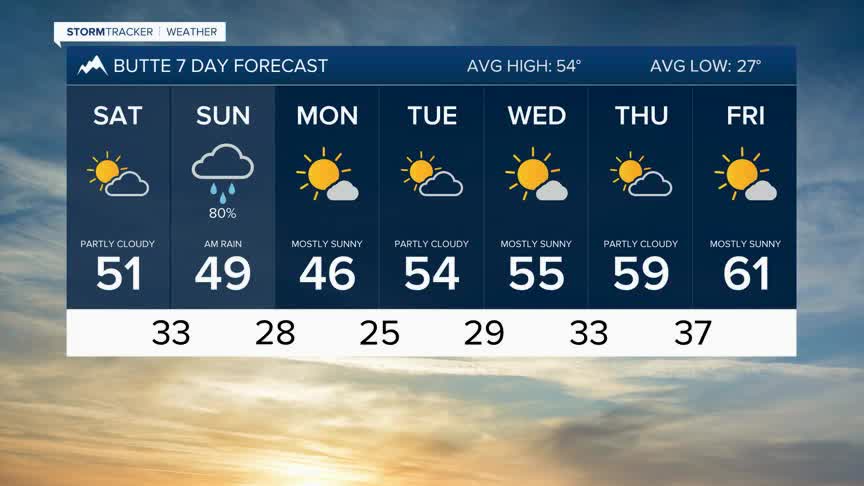


BOZEMAN – The weekend weather pattern will be split by mostly dry, mild and windy conditions on Saturday, and a cool wet and windy pattern on Sunday.
A weak disturbance could produce a few isolated showers and blustery conditions Friday night with most of this system gone by sunrise Saturday.
Temperatures will be near normal with a slight push of warmer air preceding the next weather maker on Saturday.
Late Sunday morning a Pacific storm system will move into western Montana and reach SW Montana by late morning through early afternoon on Sunday. This storm does look favorable for widespread valley rain and higher mountain snow.
Western Montana will see the brunt of the moderate rainfall Sunday, but there could be some impressive pockets of moderate valley rainfall over SW Montana.
Ahead of this storm surface wind gusts will be increasing Saturday afternoon into Sunday afternoon with high wind highlights up for the front range of the Rockies.
