


Today's Forecast:
Friday will once again bring some thunderstorms to the region and once again a few of these storms will approach severe criteria. While some of these storms could produce damaging wind and hail, we are probably not going to see the same intensity for those storms as we did Thursday. Highs will still stay in the middle 80s. Storms are expected to begin firing off around 1 PM with the most intense storms expected between 3 PM and 7 PM. A few showers will stick around through 10 PM tonight before clearing.
BOZEMAN: High: 85; Low: 58. Friday will bring another round of t-storms to the region. A few of those storms could bring 1” hail or winds in excess of 58 mph. Most of our storm activity will move in after 3 PM. Scattered showers or thunderstorms are expected to roam the area through 10 PM. Be prepared for the potential of strong storms through the mid-evening.
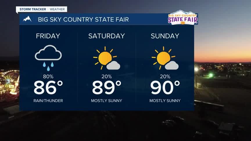
BUTTE: High: 85; Low: 54. Expect scattered thunderstorms to develop this afternoon and evening. A few of these storms could bring hail and gusty wind. Most of the afternoon and evening storms will also bring some short but intense bouts of rain. Minor flooding is possible if these storms are directly overhead. Showers will continue through about 9 PM before clearing the area.
DILLON: High: 83; Low: 57 Expect to see a few thundershowers after 1 PM today. Temperatures will quickly warm into the middle 80s. Winds will stay out of the west between 5-10 mph. A few of those storms could produce damaging wind or 1” hail through the early evening.
WEST YELLOWSTONE: High: 83; Low: 47. Temperatures will warm up quickly for your Friday with highs in the low 80s. Thunderstorms are expected by the late afternoon and early evening. We will see these storms mainly after 2 PM and should either fade or move out of the area by 11 PM. A few of these storms could bring some intense but short-duration rain of up to a half inch.
STORM OUTLOOK FOR FRIDAY
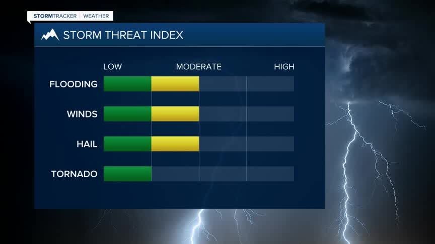
While we don’t expect the same intensity of storms as we were looking at Thurday, severe weather is still expected and we could see winds in excess of 58 mph and 1” hail threaten the area. Our severe storm risk is considered ‘Marginal’ for the afternoon and early evening, but please don’t let that term fool you. On a scale of 1 to 5 for risk, we are considering today a 1 for severe weather.

Thursday’s storms brough 1” hail to Butte with hail reports from Wise River to Clancy. MTN’s own John Emeigh sent us this photograph of hail for the early evening in Butte. Today will be similar, but likely not as widespread.
