


Today's Forecast:
Temperatures are still hot, but our highs will be just a touch LESS hot today than they were over the weekend. We are seeing a stream of mid-level moisture moving through the middle atmosphere which could produce a few isolated thunderstorms in the region this afternoon. While the severe threat is relatively low for the region, we have the potential for winds gusting near 60 mph as we get into the early evening. Highs are expected to be near 90° under partly cloudy skies for the afternoon.
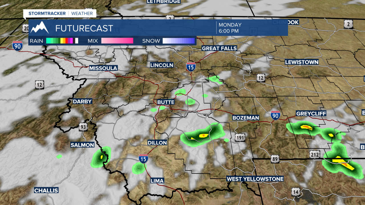
BOZEMAN: High: 93; Low: 59. Temperatures will warm up quickly for your Monday under mostly sunny skies. Clouds are expected to build in the afternoon as we have a few isolated thunderstorms develop in the summer heat toward the evening. Our main concern with our storms is the potential for damaging wind in excess of 60 mph through the sunset. These storm chances will be sparse.
BUTTE: High: 88; Low: 57. It will be a little cooler this afternoon, mainly because of afternoon clouds that will build. There is an isolated t-storm chance, but those chances are primarily to the south of Butte. If there are any t-storms that develop, we should be aware of gusty winds from the base of those storms.
DILLON: High: 90; Low: 60. It will be dry and hot in Beaverhead County and our rain chances are slim. If we do see any thunderstorms, they will be developing overhead and pushing off to the east in the mid-afternoon.
WEST YELLOWSTONE: High: 91; Low: 48. Lots of sunshine will push these daytime temperatures into the upper 80s and low 90s quickly. We are expecting to see a few showers develop this afternoon, though our better chances are going to be slightly to the north. That said, you should be prepared for a few area t-storms through 8 PM tonight.
WEEKEND RECORDS AND RAIN CHANCES THIS WEEK
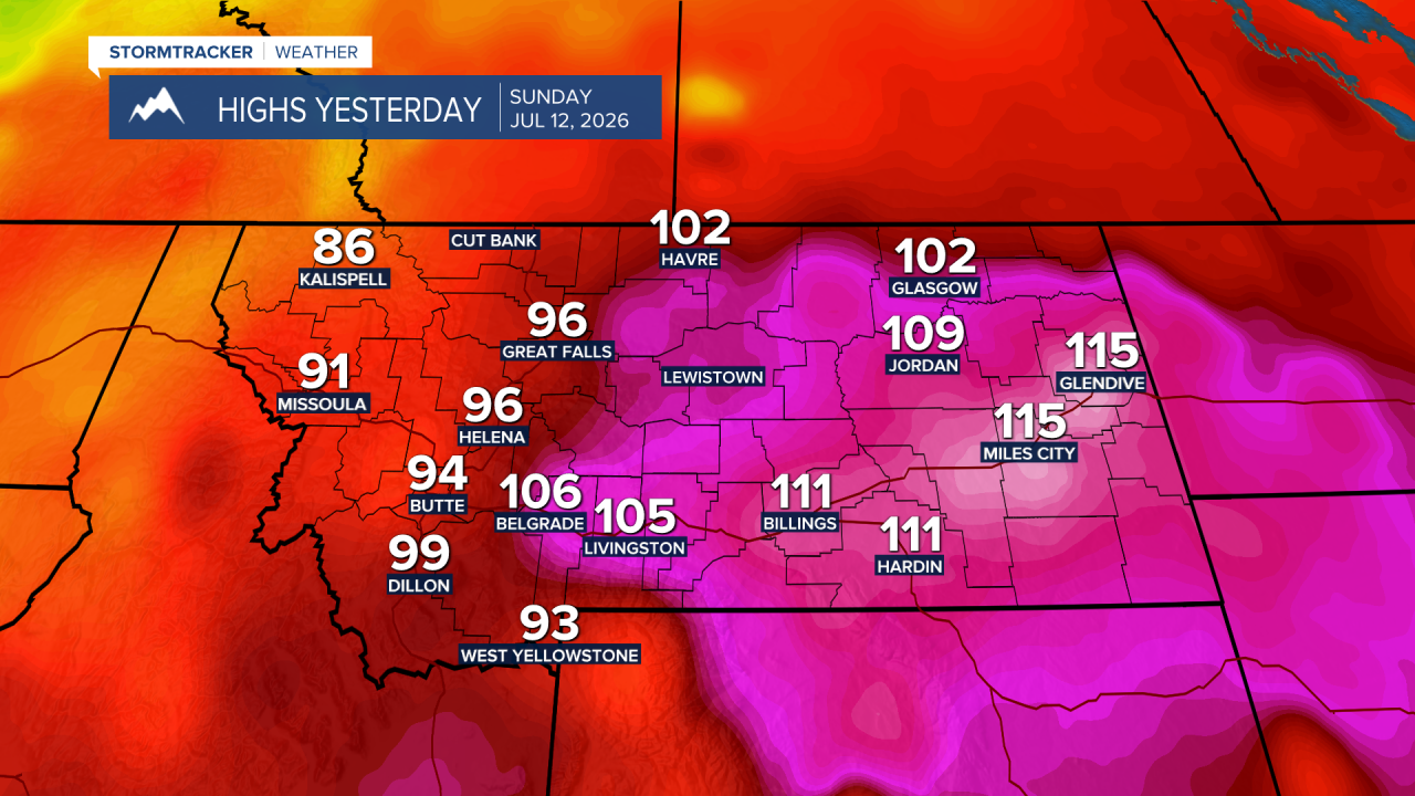
Records were set across Montana all weekend long. The most impressive heat was on Sunday with several all time records set in eastern and central Montana. I’ve included some of the more impressive numbers that have rolled into the STORMTracker Weather Center.
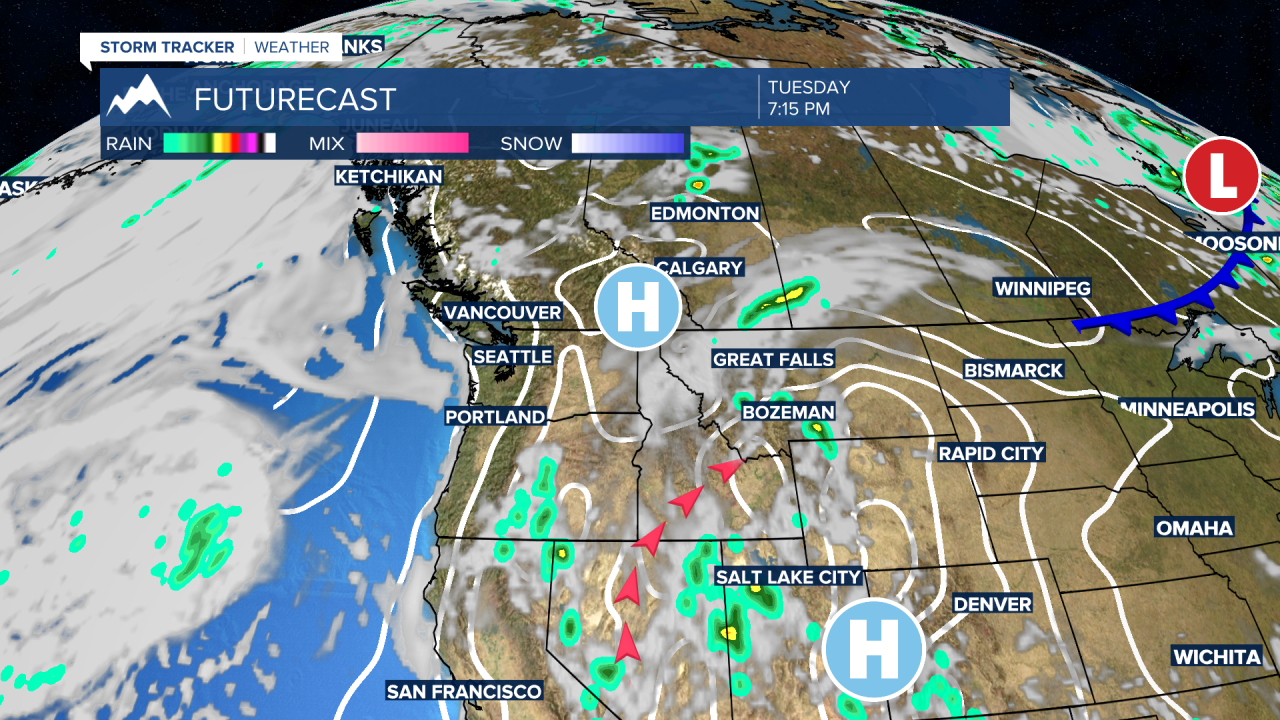
This week will cool slightly as we see better chances for rain to begin to roll into the region. We are tapping into moisture from the tropics and will shovel it our general direction this week. This will bring us rain potential nearly every afternoon for the next several days. While the middle portion of the atmosphere will have moisture, we remain dry toward the surface of the earth. That means that we may see thunderstorms with limited rain (a lot of this rain will evaporate before hitting the ground) but could produce gusty wind from a few of these storms. Severe weather potential is low, but with gusty wind and overall dry conditions I would expect our fire danger to climb as a result.
