


BOZEMAN – The last 24 hours brought some much needed moisture to SW Montana with numerous reports of a half an inch or higher at lower elevations and heavy wet snow over higher elevations.
Month to date precipitation departures from normal (October) Dillon is about a quarter of an inch above normal, Belgrade almost three quarters of an inch above normal, but Butte is around two tenths of an inch below normal.
Year to date departures from normal remain well below normal by around 2” to 6” across the entire state. Thus, the recent rain and snow has only brought some minor relief to the ongoing drought over Montana.
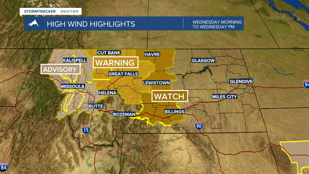
The next weather maker arrives Tuesday night into Wednesday morning. A powerful cold front and deep area of Low-pressure will produce scattered snow showers over most mountains and passes Wednesday but it’s the wind that could produce property damage.

As of 1 pm Tuesday, the National Weather Service has a variety of Wind Advisories, High Wind Watches, and High Wind Warnings up from 4 am to 9 pm Wednesday.
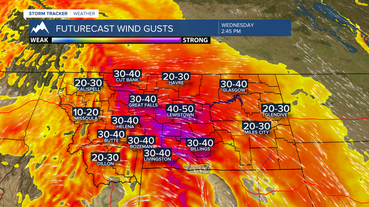
Most areas should see peak wind gusts between 30 to 50 mph Wednesday. High wind prone areas could see gusts between 50 to 60 mph and peak gusts over 60 mph are possible. Not a good day for traveling around Montana Wednesday.
Temperatures will remain cool again Wednesday with this strong cold front passing through region but slowly moderating temperatures begin on Thursday and continue into Friday before another round of cooler air arrives this weekend.
