


BOZEMAN – Plenty of active weather impacting travel conditions around Montana, Idaho, Wyoming, and Washington State.

A warm front continues to slowly drift into western Montana producing snow, heavy at times west of the divide, and some localized gusty winds.
Heaviest snow totals continue to be around far western Montana with moderate snow reports from Butte to Bozeman to West Yellowstone.
Snow will continue tonight into Friday but mostly mountains and passes will be impacted with little to minor snow accumulations for lower valleys.
A cold front will push through the state Friday morning through Friday evening. This front will bring scattered mostly mountain snow showers, but it could also produce stronger surface wind gusts and blowing snow could have a significant impact on travel conditions at all levels.

The National Weather Service continues a WINTER STORM WARNING west of the divide through Friday morning. Mountains could see more snow impacting travel for most mountain passes. Lower elevations could see some snow bands with short duration intense snow with little accumulations.
The National Weather Service also continues a WINTER STORM WARNING for the backcountry areas near Cooke City. The Absaroka-Beartooth ranges could see moderate to heavy snow through Saturday morning along with very gusty winds and blowing snow.
The National Weather Service has extended a WINTER WEATHER ADVISORY for SW Montana east of the divide through 3 pm Thursday. Little to no new valley snow is likely but mountains and passes could still see some intense snow bands through this afternoon creating low visibility travel issues.
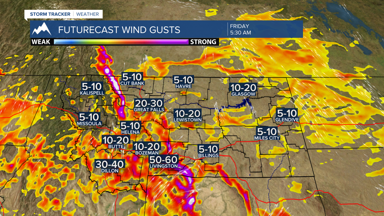
The National Weather Service has a HIGH WIND WATCH up for central and northern Montana for Friday. Wind gusts to or over 60 mph are possible and could produce whiteout blizzard like travel hazards.
SW Montana will see increasing surface winds by Friday morning and in high wind prone areas like Livingston gusts over 50 mph are possible and with all the ground snow look for blowing and drifting snow and low visibility travel hazards. This could also be possible for other wind prone areas locally like Norris Hill, Three Forks, Whitehall, Dillon, Monida Pass, and Warm Springs. If you plan to travel on Friday, please be prepared for blowing snow and slow go travel conditions.
Finally, the extended forecast for next week will be quiet and mostly dry with near to slightly above normal temperatures.
