


BOZEMAN – A mostly dry cold front will pass through Montana Tuesday afternoon into Wednesday morning.
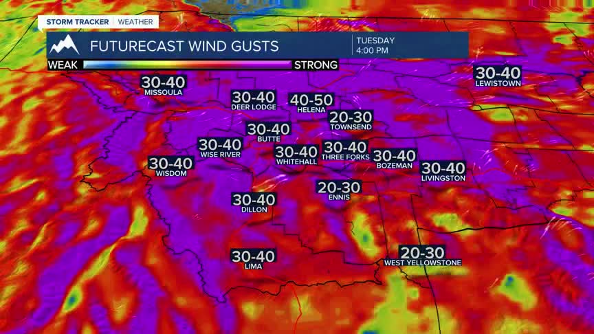
Ahead of the front look for increasing surface wind with peak gusts 40 to 60 mph possible by Tuesday afternoon.
The National Weather Service has issued Wind Advisories west of the divide and High Wind WARNING for portions of SW Montana east of the divide. West to SW winds will increase throughout the day on Tuesday with sustained winds 20-40 mph Tuesday afternoon and localized peak gusts around 60 mph.
Temperatures will be slightly cooler Wednesday and Thursday but should still remains lightly above normal.
Look for another temperature spike Friday into Saturday.
