Today's Forecast:
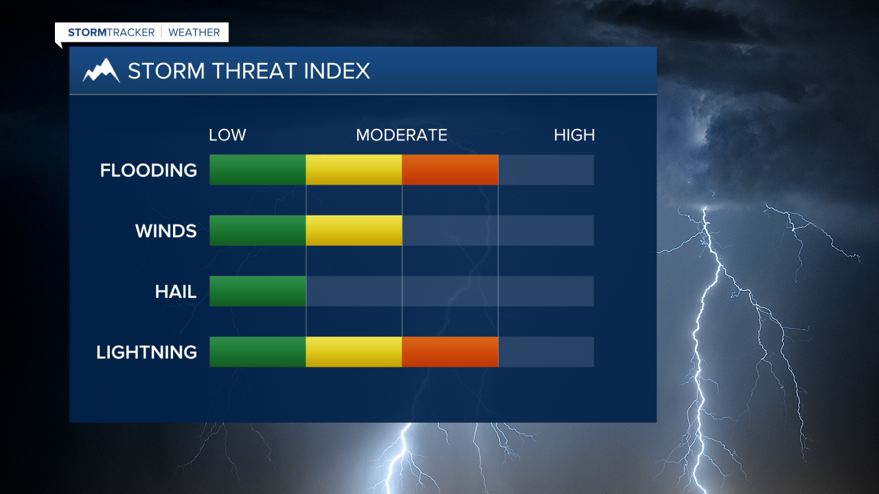
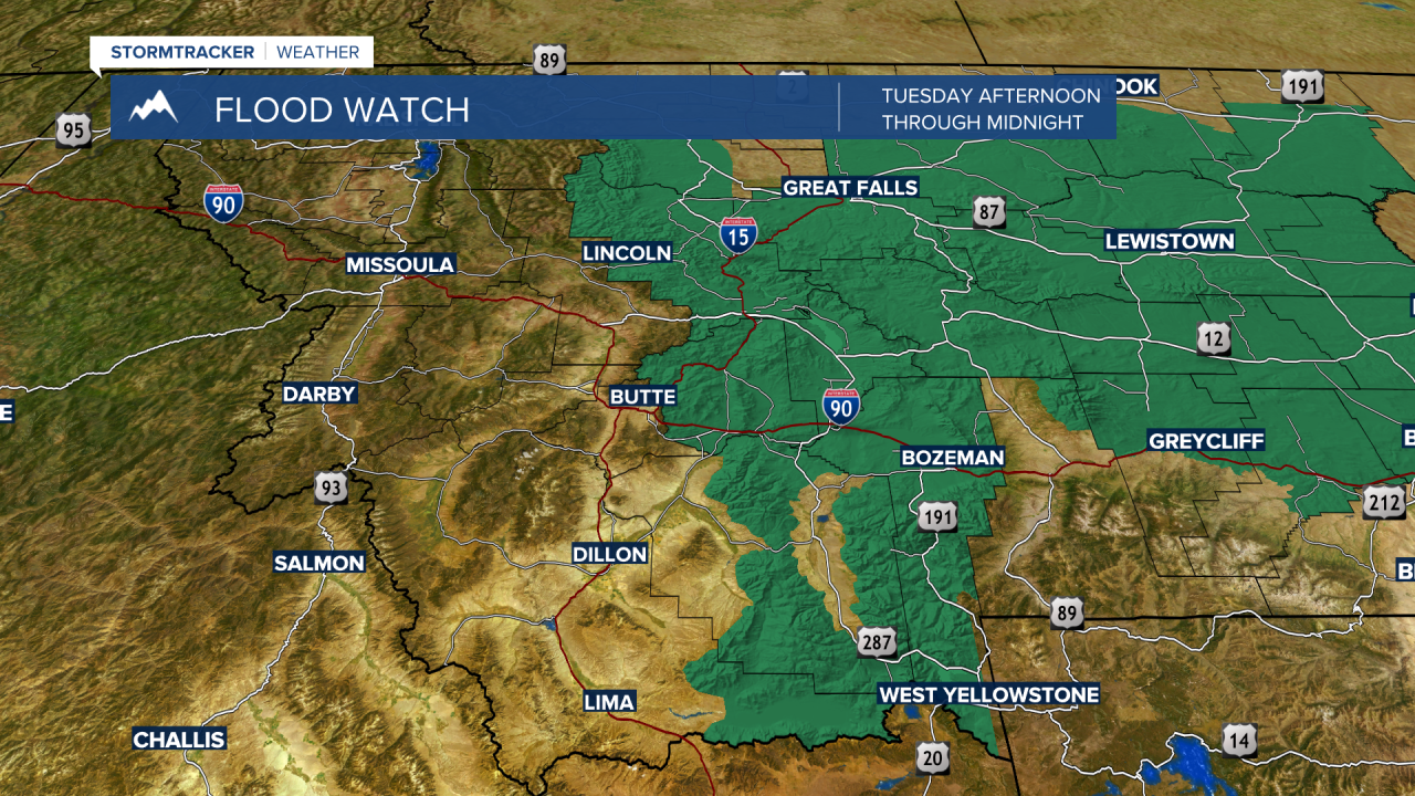
Temperatures will remain hot with above average highs near 90° today. We are getting some moisture to move back to the region which will allow a few afternoon thunderstorms to develop in the area. We don’t expect storms to be widespread, but we do see the potential for a few of these storms to produce pockets of heavy rain, gusty winds and hail. A few rain chances are expected to redevelop overnight with spotty showers likely again on Wednesday. We do have some flood watches that are in effect for the region for the afternoon through midnight.

BOZEMAN: High: 90; Low: 59. Temperatures will warm up quickly with plenty of sunshine to start the day.With highs near 90°, we will see afternoon thunderstorms work through the region. Our biggest concern deals with heavy rain and flooding potential, but we will also be tracking the chance for damaging wind and small to moderate hail through the evening. Another round of t-storms will be likely after midnight.
BUTTE: High: 86; Low: 56. We will warm up in a hurry again today with highs in the middle 80s. We will look at a few t-storms trying to develop by 3 PM and will push through the region through the evening. Overnight could bring a stray shower or two after sunset.
DILLON: High: 87; Low: 59 Expect warm temperatures and sunny skies through the early afternoon before we see a few t-storms develop after 5 PM. Scattered showers are possible throughout the evening with a spotty shower possible before dawn on Wednesday.
WEST YELLOWSTONE: High: 90; Low: 52. With highs in the upper 80s and low 90s and plenty of sunshine, water and sunscreen should be key to enjoying the day. Rain chances south of Big Sky to West Yellowstone will be low during the day, but we do see some rain and thunderstorms developing after midnight. Severe potential for the immediate area will be low but be prepared for several rain chances this week.
STRONG STORMS AND FLOODING POTENTIAL:
The current weather pattern is tapping into some tropical moisture that will consistently work back into southwest Montana over the course of the next week or so. With that moisture available and temperatures consistently in the 80s to low 90s, we can expect nearly daily rain chances during the afternoon and early evening.
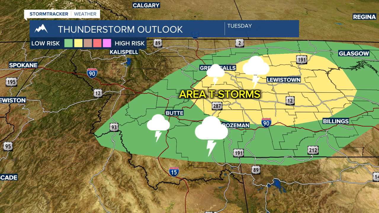
Storms for your Tuesday do have the chance to be strong. The Storm Prediction Center out of Norman, Oklahoma has put out a ‘slight risk’ for severe storms just to the north and east of the area. Some of those storms will be developing over the area and could produce some gusty wind. Besides the potential for flooding, our biggest storm threats are for winds more than 58 mph, which is considered the minimum criteria for thunderstorm warnings to be issued. That will primarily be for the late afternoon and early evening.
Pockets of heavy rain will emphasize the flooding potential through midnight. We also will see frequent lightning with a few of these storms. With relatively dry conditions and curing vegetation, our wildfire risk is slowly on the rise through the course of the week.