


BOZEMAN – A Candian clipper is passing through Montana mostly east of the divide Friday afternoon and evening producing scattered valley rain, isolated small thunderstorms, and higher mountain snowfall.
Forecast models show the best chance for measurable precipitation will be from Boulder to West Yellowstone eastward tonight into Saturday morning.
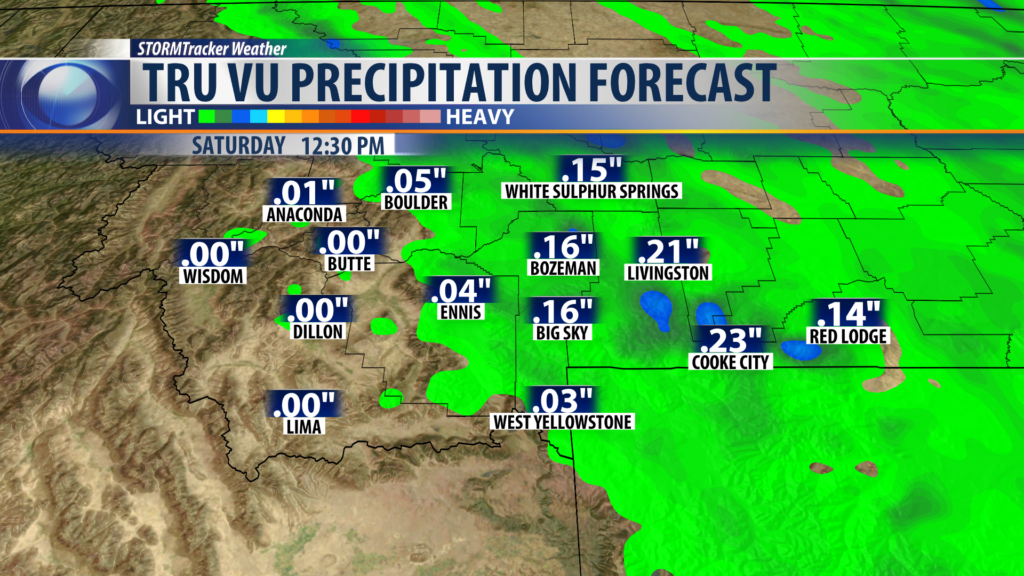
This storm system will quickly pass through tonight and should be gone by late Saturday morning. The rest of the weekend weather pattern will be dominated by stronger High pressure with warming temperatures and mostly dry conditions for Montana.
The warmest temperatures so far this Spring are likely on Sunday.
City by City Forecast:
BOZEMAN: LOW: 36°; HIGH SATURDAY: 68°. Mostly cloudy tonight with scattered showers, isolated early thunderstorms, and even a little mountain snow. This weak disturbance will be gone by Saturday late morning and the rest of the weekend is looking fantastic with warming temperatures and mostly dry.
BUTTE: LOW: 33°; HIGH SATURDAY: 67°. Chilly again tonight with partly cloudy skies after midnight. Mostly sunny Saturday and Sunday and warming up slightly above normal.
DILLON: LOW: 34°; HIGH SATURDAY: 70°. Cloudy and breezy this evening with clearing skies by Saturday morning. Mostly sunny and warm this weekend.
WEST YELLOWSTONE: LOW: 25°; HIGH SATURDAY: 62°. Scattered rain or snow is likely tonight into Saturday morning. Isolate weak thunderstorms are possible. Minor snow accumulations are possible above 6,000′ inside Yellowstone National Park. Mostly sunny and mild by Saturday afternoon and again Sunday.
