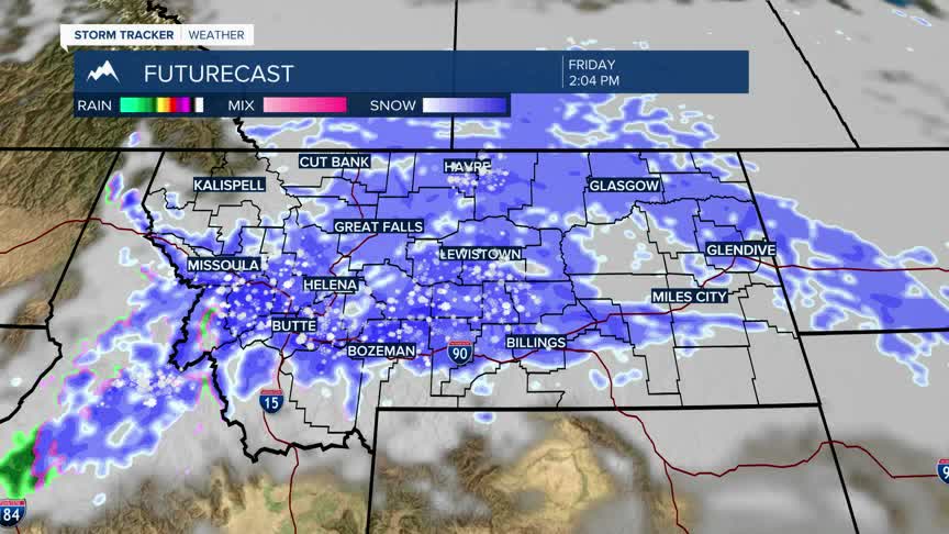


BOZEMAN – Pay close attention to the latest forecast as our first significant winter storm is coming Thursday afternoon through Friday night.
The combination of rain, snow, pockets of freezing rain, localized wind gusts up to 40+ mph, brief periods of moderate to heavy snow and Arctic air will create significant travel hazards across the state.
SW Montana will be in the warm air sector of an approaching Pacific storm Thursday with highs reaching the low to mid 40s. This is warm enough for mixed precipitation Thursday afternoon into Thursday early evening.
As an area of Low-pressure drops in from the North Thursday evening into Friday afternoon rain changes to snow and Arctic air develops Friday. This could easily create flash freezing of wet roads by Friday late morning into the afternoon.
Localized wind gusts to 40 mph could also develop as the cold front moves through Friday afternoon, producing areas of blowing snow and very low visibility travel hazards.
Most of the moisture will drop to the SE by Saturday morning, but the colder modified Arctic air will linger all weekend.
