


UPDATE: 8-13-2026, 10:35 a.m. — According to the latest update from Bobcat Lakes & Sand Creek Fires Information, the Beaverhead Sheriff's Office has ordered evacuations for several communities as firefighters battle the Sand Creek Fire and the Bobcat Lakes Fire.
WATCH FULL STORY HERE:
Elkhorn Hot Springs and Maverick Mountain are under a GO evacuation status. The order covers all communities extending north from Billings Creek, as well as areas from Polaris to the MA Barnes Subdivision in Grasshopper Valley.
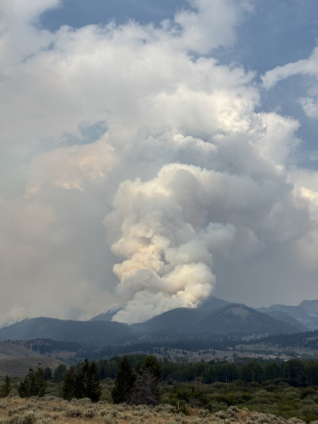
The northern edge of the Sand Creek Fire has passed the south side of Odell Mountain. The eastern tip of the fire has crossed into the Elkhorn Creek Drainage, east of Elkhorn Hot Springs. The western edge is moving toward a completed dozer line, where fuel changes from timber to sage and grass.
Crews built a handline from Maverick Mountain down to Grasshopper Creek to help hold the fire north of the Maverick Lodge. A second dozer line is progressing along the west side of Grasshopper Valley, running from Shale Creek to Divide Creek. That line will eventually tie into Forest Service Road 928.
Firefighters are cooling down hot spots near structures at Maverick Mountain and Elkhorn Hot Springs.
The Bobcat Lakes Fire pushed hard against Pattengail Creek Wednesday. Crews are holding the eastern edge of that fire at the Pioneer Mountains Scenic Byway. Firefighters installed hoses and pumps along the west side of Jerked Prairie to help protect structures in the area. Crews will also secure the southeast corner of the fire Thursday. Firefighters conducted firing operations in that area Wednesday.
A smoke inversion lifted around noon Wednesday, allowing aircraft to assist crews on the ground. Aircraft dropped water near threatened structures, and a large air tanker dropped retardant on the Odell Mountain communication site to help protect it from approaching flames.
Weather conditions could provide some relief Thursday. There is a 50% chance of showers and thunderstorms, expected mainly after 3 p.m. Wetting rain could slow the spread of the fires, and winds are expected to be calmer. However, heavy fuels remain very dry due to a lack of snow and rain.
Fire officials are hosting a community meeting Thursday night at 6 p.m. at the Wise River Community Center. A live stream of the meeting will also be available on the Beaverhead Deerlodge National Forest Wildland Fire Information Facebook page.
PREVIOUS:
Firefighters are battling the Sand Creek Fire in the Grasshopper Valley of Beaverhead County, where the blaze has destroyed a ski shack and chairlift at Maverick Mountain Ski Area and threatens homes, cabins, and livestock in the region.
Helicopters are pulling water from a nearby pond to douse flames on the mountain as crews on the ground work to protect structures. The fire has crossed the Pioneer Mountain Scenic Byway.
Despite the destruction at the ski area, firefighters have been able to protect the lodge, Elkhorn Hot Springs, and other structures in the area.
Homeowner Larry Tayler credited firefighters, bulldozer crews, and hotshot crews with saving homes in his subdivision located across the road from the ski hill. After Tayler noticed fire activity behind his home and called for help, crews responded quickly.
"This one, that one, that one. This subdivision...it could've all went...and it's all because of what these boys did. All the work that they did," Tayler said.
Fire planes also strategically dropped fire retardant along ridges to protect homes in the area.
"Had they not been here, I have no doubt that all of these cabins would be gone," local resident Jennifer McKay said.
As the fire continued to grow behind McKay's cabin and other homes, the threat remained visible and immediate.
"There's so much deadfall up there!" McKay said.
Cowboys and ranchers are also working to save cattle that graze on public land during the summer months. Scott Mickelsen rides the range for area ranchers and said the financial toll on ranching families could be severe.
"These ranchers....probably get emotional....but these ranchers have the rights to graze these properties and to put cattle on them. So, when this type of activity happens, sometimes the next year... two years they can't graze them at all. So, it causes financial distress. What do the families do?" Mickelsen said.
Mickelsen said the impact extends beyond ranchers.
"It's a huge impact not only to the people that enjoy the outdoors, but it's the people who depend upon these lands for a living," Mickelsen said.
Tayler reflected on the situation as firefighters continued their work.
"It's a sad, sad thing that has happened, but we feel pretty good about it now. It's a long ways off, I think, before it's over," Tayler said.
According to officials, the Sand Creek Fire is located about 8 miles southeast of Wisdom, is zero percent contained, and has burned over 27,500 acres. The Bobcat Lakes Fire, located 13 miles southwest of Wise River and 12 miles east of Wisdom, has burned just over 9,000 acres and is also zero percent contained.
This story was reported on-air by a journalist and has been converted to this platform with the assistance of AI. Our editorial team verifies all reporting on all platforms for fairness and accuracy.
