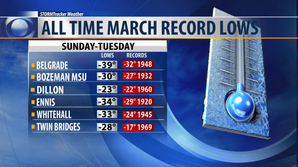
BOZEMAN – The official report from the Great Falls National Weather Service office has a long list of all-time record lows for March across SW Montana.
The only reporting station that did not shatter their all-time record low for March was West Yellowstone.
The most impressive all-time record lows was Bozeman Yellowstone International Airport with -39 below zero on Monday morning March 4th, 2019.
As you can see from the graphic above extreme cold hit SW Montana Sunday through Tuesday with most of the all-time records observed on Monday morning. Some of the all-time past records date back to 1920 in Ennis.
This incredible cold snap was the result of a blocking High pressure ridge of Alaska the forced the Polar jet stream to pull deep Arctic air southward through Canada down into the Northern half of the United States. Numerous daily record were shattered across all areas of Montana Sunday through Tuesday both west and east of the divide.
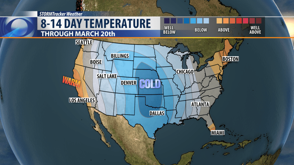
Below normal temperatures started in early February and continues into the first week of March. Unfortunetly the Climate Prediction Center 8 to 14 day temperature outlook has most of the Northern half of the country stuck with more cold at least through mid March.