


BOZEMAN – A pattern change is here and should kick temperatures up into the 30s and 40s for the rest of the week for SW Montana.
Gusty winds are developing with a stronger southerly flow aloft for wind prone areas like Ennis, Norris Hill, Monida, and Whitehall but that will help scrub out some of the lower level cold pools.
The other weather hazard is snow along the Montana-Idaho border tonight through Friday. A narrow band of moderate to heavy snow is likely to impact travel mostly on the Idaho side of Monida Pass but plan on difficult travel on the Montana side as well through Friday.
The National Weather Service continues a WINTER WEATHER ADVISORY for the far southern end of Beaverhead, Madison, and Gallatin counties through Thursday evening.
Areas impacted: Monida pass, Raynolds pass, Targhee pass, and West Yellowstone.
Snow accumulations: 4”-8” of valley snow is possible with up to or over a foot of snow for higher elevations.
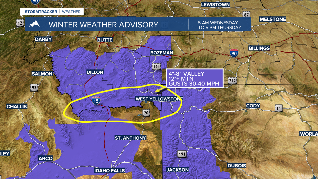
NOTE: The National Weather Service disseminates watches, warnings, and advisories with county fill maps. This leads to confusion especially when the counties are very large like Beaverhead, Madison, and Gallatin counties. It’s easy to assume that all areas highlighted are going to see snow, that is NOT the case with this storm. The only areas to see moderate to heavy snow will be along the MT/ID state line.
If you find the information confusing, please let the NWS forecast offices know in Missoula and Great Falls. We have asked numerous times for improved highlighted maps when it comes to severe weather graphics.
