Today's Forecast:
Today will be the last day of unseasonably warm weather across southwest Montana before a major pattern change arrives this weekend. Expect sunny skies, well above normal temperatures, gusty southwest winds, and elevated to critical fire weather conditions. Many lower-elevation communities will climb into the upper 70s and low 80s this afternoon.
BOZEMAN:
High: 80; Low: 51.
Sunny and unusually warm with afternoon southwest winds increasing to 10 to 20 mph and gusts approaching 40 mph. Conditions remain dry throughout the day. Clouds begin to increase overnight as the weekend storm system approaches. Elevated fire danger is expected during the afternoon.
BUTTE:
High: 76; Low: 40.
Sunny skies and warm temperatures continue through the day. Southwest winds increase to 15 to 20 mph with gusts as high as 35 mph by afternoon. Conditions remain dry before increasing clouds arrive tonight ahead of the weekend storm.
DILLON:
High: 81; Low: 45.
Sunny conditions continue with strong southwest winds developing through the afternoon. Sustained winds of 20 to 25 mph and gusts up to 40 mph are possible. Dry weather persists today, though a slight chance of rain develops late tonight.
WEST YELLOWSTONE:
High: 70; Low: 36.
Mostly sunny and breezy with southwest winds increasing to 15 to 20 mph and gusts around 30 mph. Dry weather continues today, but clouds increase tonight ahead of a much wetter weekend. Fire weather concerns remain elevated through the afternoon.
WINTERY WEATHER THIS WEEKEND
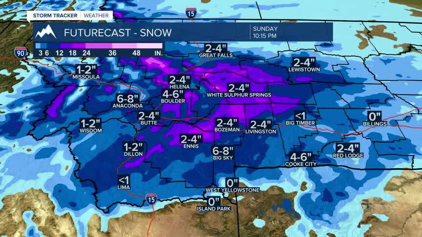
A dramatic weather change arrives Saturday through Monday as a strong Canadian storm system moves into Montana. Temperatures will fall 30 to 40 degrees behind a cold front, with widespread rain changing to snow across many locations. Forecasters expect moderate to heavy mountain snowfall, with some lower-elevation communities potentially seeing accumulating snow by Sunday. Cooler and unsettled weather is expected to continue into next week.
RED FLAG WARNING
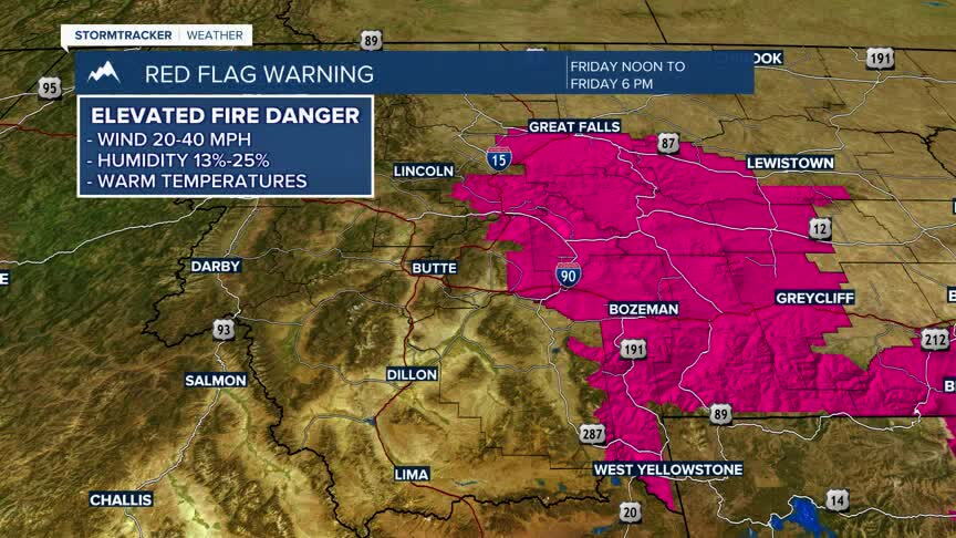
A Red Flag Warning is in effect today across portions of central and southwest Montana due to warm temperatures, low humidity, and strong winds. Relative humidity is expected to fall into the teens while southwest winds gust between 40 and 45 mph. Any fire that develops could spread rapidly and become difficult to control. Outdoor burning is strongly discouraged.
WINTER WEATHER ALERTS
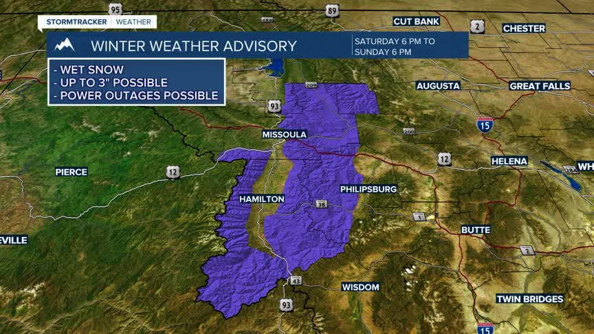
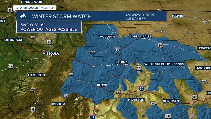
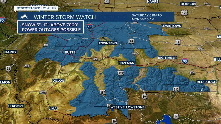
Winter Storm Watches have been issued for portions of southwest and western Montana beginning Saturday evening and continuing through Sunday or early Monday. Areas including the Butte region, mountain passes, Gallatin and Madison County mountains, Centennial Mountains, and the West Yellowstone area could receive significant accumulations of heavy, wet snow. Mountain snowfall totals of 6 to 12 inches are possible, with difficult travel conditions expected over higher-elevation roads and passes. Gusty winds may further reduce visibility and create hazardous travel conditions.