BOZEMAN – Another crazy weather week for Montana and most of the region. There will be big travel impacts with wind, blowing snow, new snow, and another round of Arctic air.
First is a Pacific storm moving in Monday afternoon through Tuesday afternoon. Scattered snow off and on snow bands with gusty wind will bring difficult travel conditions by Tuesday morning.
Second, an Arctic front dives southward beginning Tuesday morning and reaching SW Montana by Wednesday into Thursday. This Arctic front is not forecast to dig across the entire SW corner of Montana but look for much colder temperatures from Butte to Bozeman northward.
At the same time the Arctic front is moving in from the north another round of warm moist Pacific air is pushing in from the SW. As these two collide more widespread snow, blowing snow, difficult travel conditions and bitter wind chills set up by Wednesday morning through Thursday morning.
The Arctic air will rapidly retreat to the east and temperatures could jump back above normal by the end of the week.
Here are the National Weather Service highlights:
The National Weather Service issued a WINTER WEATHER ADVISORY for most of Montana tonight through Tuesday afternoon. Snow and blowing snow will impact travel. Snow accumulations in general will be around 3”-6” at pass level and higher. Most lower valleys could see several inches of snow by Tuesday morning. Localized wind gusts to 50 mph are possible producing areas of blowing snow and low visibility.

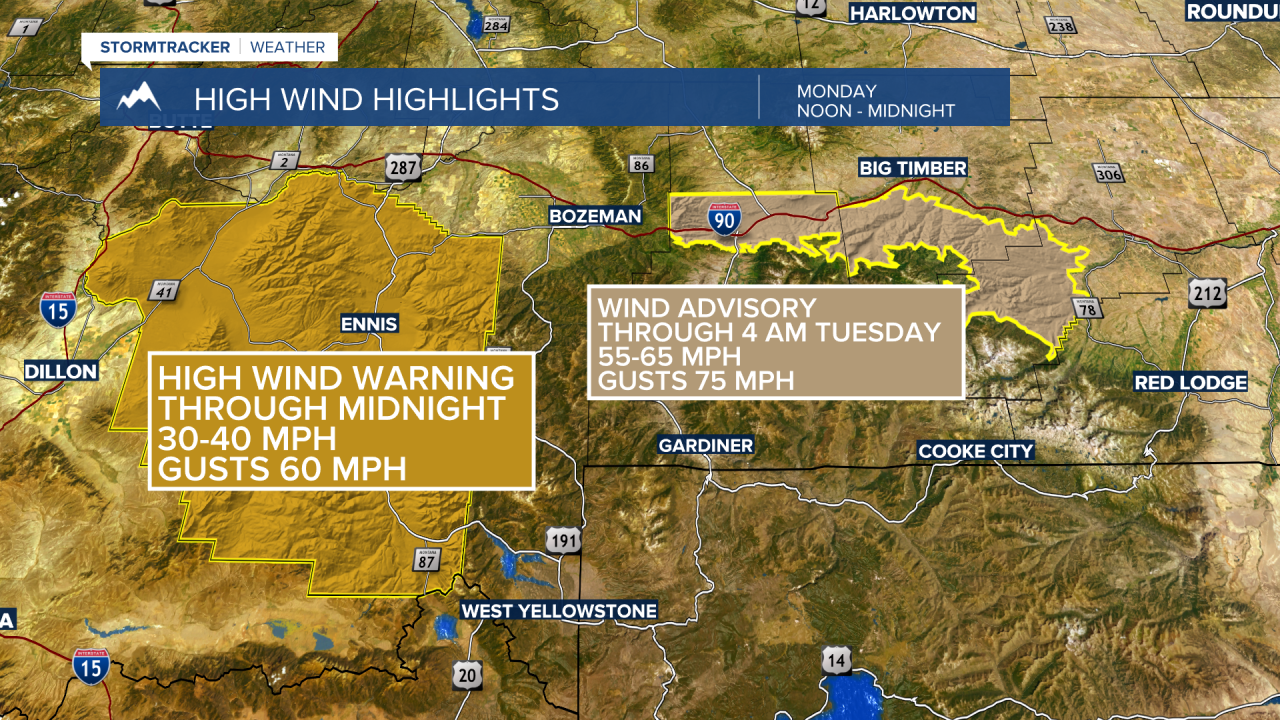
The National Weather Service continues a HIGH WIND WARNING for Madison County through midnight Monday with peak gusts up to 60 mph possible. A WIND ADVISORY continues in the Livingston area through early Tuesday morning with gusts up to or over 75 mph. This has forced a road closure of I-90 Monday afternoon and traffic must detour through Livingston to bypass a dangerous crosswind area of I-90.
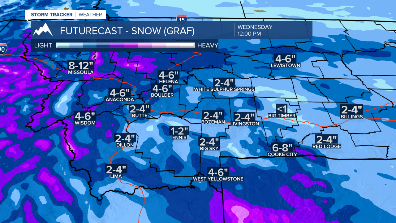
Two rounds of snow for SW Montana. The first round arrives Monday night into Tuesday morning. Mountains and passes could see 2”-4” or more. Lower valleys will most likely see 1”-2” of snow and some could see a little more.

Second round of snow will arrive Tuesday night into Wednesday. Mountains and passes could see another 2”-4” or more of snow but lower valleys could also see 2”-4” or more of snow. This will be an Arctic front colliding with Pacific moisture and that is a great pattern for producing widespread snow and travel impacts.