


Today's Forecast:
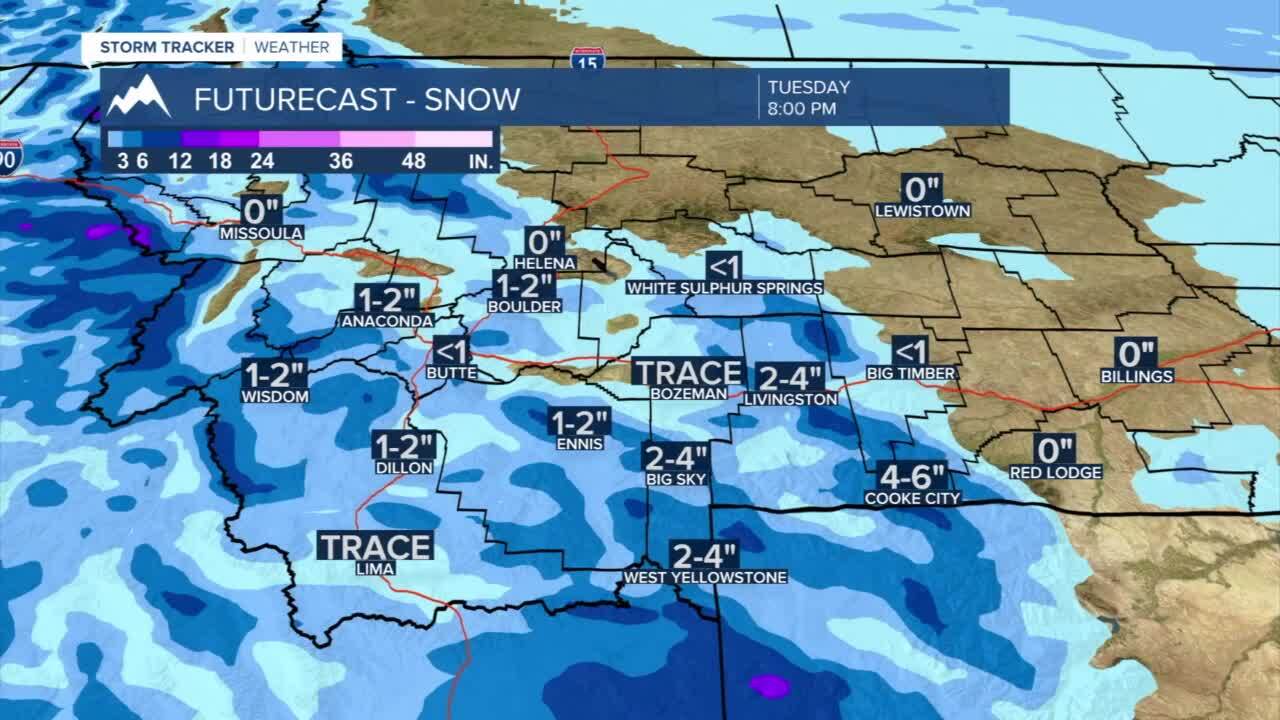
Scattered snow showers and extremely strong wind could make driving in western and southwestern Montana dicey. Scattered snow showers will push through the area through the day but winds are expected to be sustained between 15-30 mph for much of the area with wind gusts approaching 40 mph to 60 mph for peak gusts through the evening. Blowing and drifting snow will likely affect road conditions and visibility. Snow amounts, especially for valleys, are expected to be near 1” or less in valleys with heavier snow approaching 3”-6” in the mountains. Wind chill values during the afternoon will likely be in the teens and 20s for much of the day.
BOZEMAN: High: 33; Low: 17. Scattered snow showers are expected for the afternoon. Snow amounts are expected to be 1” or less, but winds gusting out of the SW to west between 15-30 mph with peak gusts over 40 mph will likely cause issues on many area roads through the afternoon and evening.
BUTTE: High: 31; Low: 9. Morning and early afternoon snow showers are likely with snow amounts near 1” are possible. Expect gusty winds out of the west wind between 15-30 mph with gusts near 45 mph. Look for drifting snow and low visibility for your Tuesday.
DILLON: High: 32; Low: 13. Scattered snow showers are possible today with accumulation near 1”-2” through the day. Gusty winds between 15-30 mph are likely.
WEST YELLOWSTONE: High: 19; Low: 8. Cold and snowy for your Tuesday in the area. We could see 2”-4” of fresh snow but gusty winds could create drifts and dangerous driving conditions.
DANGEROUS COLD EXPECTED AS WE NEAR THE WEEKEND
This week looks to bring scattered snow showers to the area, but one of the biggest concerns to the region will be dangerous temperatures and significant wind chill values near -40° at times. The arctic air is expected to drive into the area starting on Thursday with the coldest air moving Friday and Saturday. Lows by Saturday morning could be below -20°. Highs for the weekend could be near zero or below through Sunday.
