

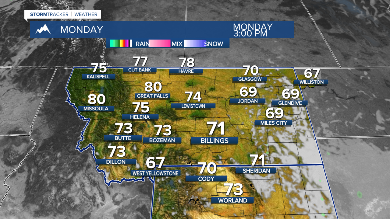


A weekend storm brought beneficial rainfall to much of Montana, but it is finally moving east and allowing a much quieter pattern to develop. After one more day of lingering rain and fog in eastern Montana and northern Wyoming, the state transitions into a warm, dry stretch that should last through most of the work week. The next chance for widespread precipitation arrives next weekend.
SUNDAY NIGHT
Rain tapers off across eastern Montana and northern Wyoming while skies slowly begin to clear. With abundant moisture left behind by recent rainfall and very light winds, widespread fog development is likely overnight. Some valleys and low-lying areas could see dense fog by Monday morning, creating localized travel concerns.
MONDAY
High pressure settles over the Northern Rockies, bringing dry weather statewide. Morning fog gradually burns off, giving way to mostly sunny skies. Temperatures climb into the 70s across much of Montana with light winds and pleasant conditions.
TUESDAY
A warm and stable weather pattern becomes firmly established. Most of Montana enjoys sunny skies and dry weather with temperatures running above normal. Morning valley fog remains possible in a few locations, but afternoons will be dominated by sunshine and comfortable conditions. A few showers are possible in southwest Montana, including Butte.
WEDNESDAY
Warm temperatures continue statewide with highs generally running around 10 degrees above seasonal averages. Dry weather dominates from western valleys to the eastern plains. A weak disturbance could produce an isolated shower across portions of northeast Montana, but most areas remain dry.
THURSDAY
One of the warmest days of the week is expected across Montana. Sunshine, dry conditions, and light winds continue statewide. Afternoon temperatures remain well above normal, providing excellent outdoor conditions.
FRIDAY
The warm and dry pattern persists through the end of the work week. Temperatures remain above average across all regions of Montana with increasing southwesterly flow aloft. Most areas stay dry with only increasing high clouds signaling a pattern change ahead.
SATURDAY AND NEXT WEEKEND
Forecast confidence decreases somewhat, but a Pacific storm system is expected to move into the Northern Rockies. Clouds will increase, winds will strengthen, and chances for showers will return statewide. Temperatures trend cooler and closer to seasonal averages. Mountain snow levels remain relatively high at first but could lower later in the weekend as cooler air arrives behind the system.
