


BOZEMAN – The next weather maker is currently sitting along the NW coast Monday afternoon and should start to work inland tonight. This storm will bring increasing wind gusts and thunderstorms to SW Montana Tuesday afternoon.
Thunderstorms should develop out ahead of a cold front Tuesday afternoon first developing over local mountain ranges and lift to the NE and some of these storms will turn strong to severe but mostly across Central counties of Montana.
The Storm Prediction Center has a “marginal” or low risk for possible damaging thunderstorms over Central and Northern Montana counties Tuesday afternoon.

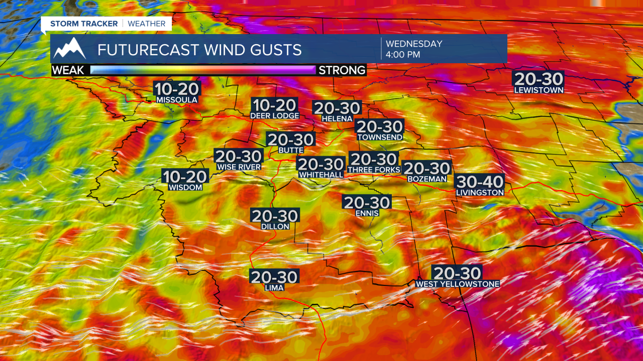
The biggest impact with this system will be increasing surface wind gusts both Tuesday afternoon and again Wednesday afternoon.
Tuesday’s strongest wind gusts will be around building thunderstorms and peak gusts over 40 mph are possible but Wednesday look for a sustained wind 15 to 30 mph and gusts at times over 40 mph.

Temperatures will be hot Tuesday ahead of the front but should begin to cool slightly behind the front on Wednesday and Thursday.
