


UPDATE: A RED FLAG WARNING now covers all of SW Montana Thursday afternoon and evening. Increasing surface wind gusts 20 to 40 mph, temperatures in the 80s and 90s, and relative humidity below 15% means new fire starts are likely across the entire region. Extreme caution is needed with all outdoor activities! Human caused fires are the primary concern.

_______________________________________________________________________________________________________________________________________________
BOZEMAN – High pressure is rebuilding over Montana today with the Polar Jet Stream sitting over the state. This combination produces mostly dry, warm to hot temperatures, and gusts surface winds.
For those reasons, a RED FLAG WARNING has been issued for most of central and northern Montana through Thursday evening at 9 pm. This includes the far eastern counties of SW Montana. Conditions are favorable for new fire starts and human caused fires are the primary concern. Please continue to use extreme caution with all outdoor activities.

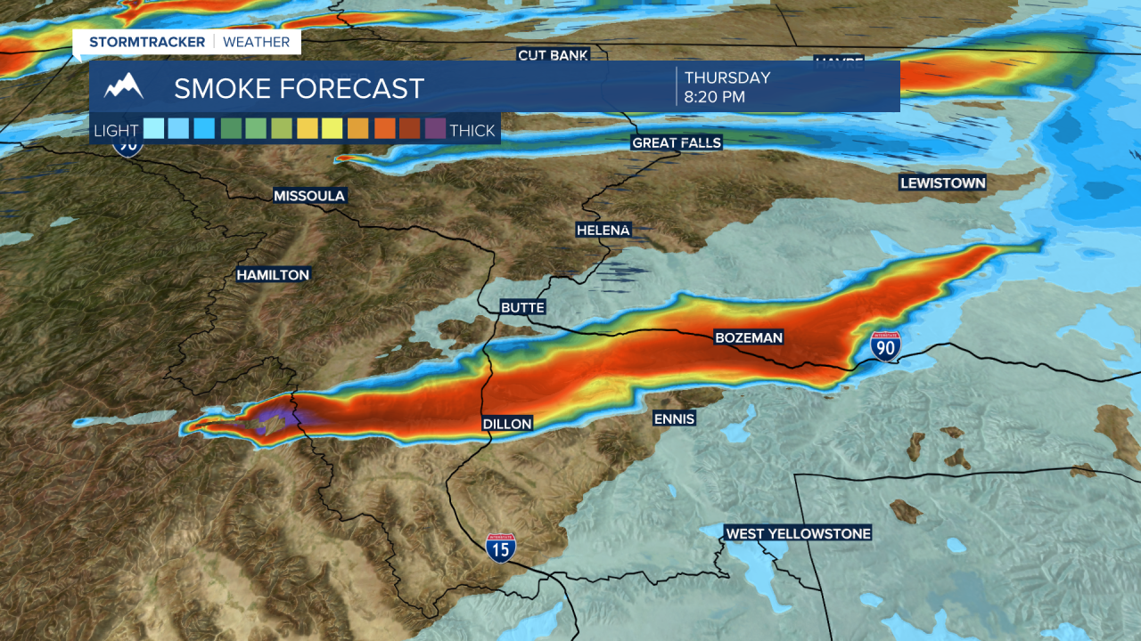
A SW flow aloft will also produce more thick wildfire smoke at times over SW Montana mostly from the large Moose Fire north of Salmon, ID.
Latest forecast models show thick smoke returning over the Dillon area by 5 pm Wednesday.

That smoke will drift eastward and lift to the north impacting Butte and Bozeman by early Thursday morning.
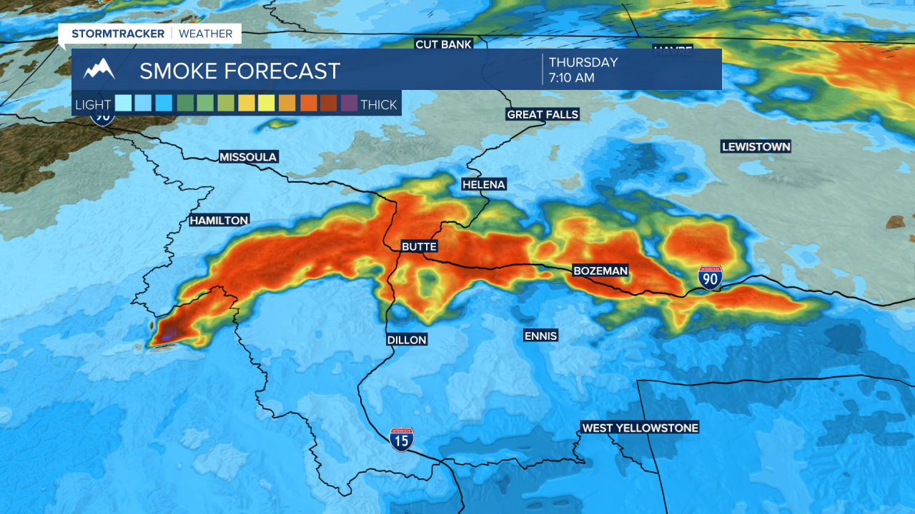
As the fire flares up Thursday afternoon a large column of smoke is likely to push back into the Dillon area and extend over Bozeman.
Air quality conditions will fluctuate over the next few days and at times ratings could fall into the unhealthy range. If thick wildfire smoke develops in your area try and limit your outdoor exposure as much as possible.
Lastly, isolated afternoon thunderstorms are possible over the eastern half of SW Montana Thursday, Friday, and Saturday afternoon to early evening. These thunderstorms could produce brief heavy rain, but lightning is the main concern for possible new fires to start locally through Saturday.
