


BOZEMAN – The next weather maker is a strong cold front that is just beginning to impact the Pacific NW coast.
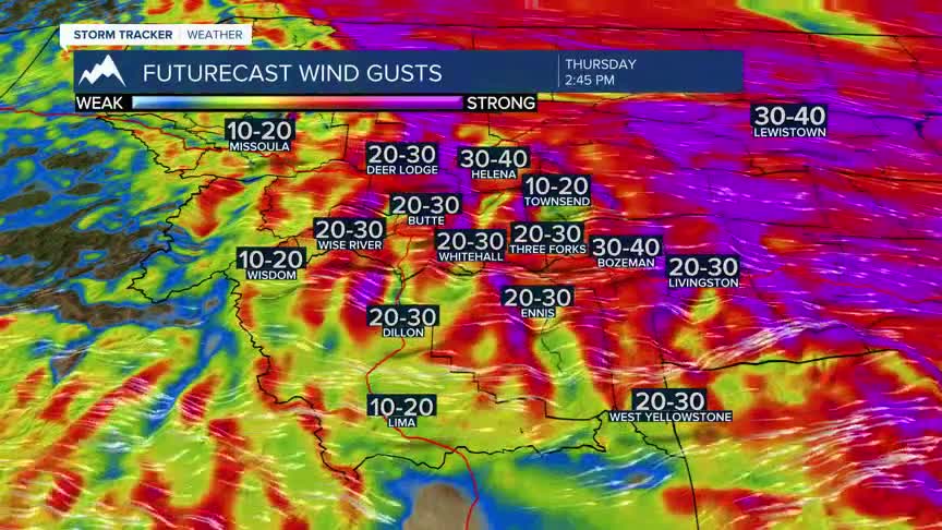
This cold front will push across Montana Friday morning into Friday afternoon. The main concern with this storm system is stronger surface wind with a Wind Advisory up for the Livingston area through Friday afternoon.
Most of SW Montana will experience surface wind with this frontal passage with sustained wind around 15 to 30 mph and peak gusts up to 40+ mph. High wind areas like Livingston could see peak gusts up to or over 60 mph. Other high wind areas to watch will be around Whitehall, Three Forks, and Ennis.
A quick shot of rain or snow is possible with this storm system Thursday night into Friday morning.
This storm will pull cooler air from Canada down into Montana Saturday as an area of Low-pressure drops through eastern Montana.
Beginning Sunday High-pressure will rebuild into the region, kicking off another warming trend that will likely linger into most of next week.
