


BOZEMAN – Caution active winter weather ahead. The combination of light to heavy, gusty surface wind and another shot of Arctic air will produce difficult to dangerous travel conditions.
There are numerous WINTER STORM WARNINGS, Winter Weather Advisories, BLIZZARD WARNINGS, and Wind Chill Advisories up across Montana Wednesday evening through Thursday afternoon.

One area to avoid Thursday will be the Flathead region. A BLIZZARD WARNING has been issued from 5 pm Wednesday to 5 am Thursday. Heavy snow at time combined with wind gusts to 45 mph will produce extremely low visibility and thus a dangerous travel weather pattern.

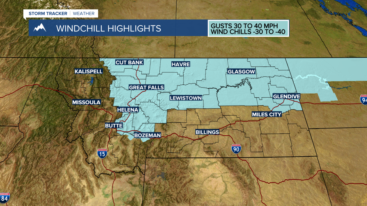
The general forecast is for widespread snow tonight into Thursday morning diminishing by Thursday evening. Most of Montana could see gusts 30 to 45 mph and localized areas of blowing and drifting snow will impact travel conditions Thursday.
A quick shot of Arctic air will be in behind this storm system and wind chills could be as cold as –40 below zero Thursday and possibly Friday morning.
A general warming trend is still on track this weekend into next week.
