


BOZEMAN – A very complex atmosphere will bring a wide variety of severe winter conditions to Montana this weekend into next week.
A large High-pressure ridge is lifting into the Gulf of Alaska forcing the Polar jet stream up into northern Canada. This is creating a NNW flow aloft over Montana and the jet stream is paving the way for several Pacific disturbances to pass over Montana creating areas of light to moderate and even heavy at times snow showers. The center line for moderate to heavy snow is from Kalispell to Billings and on either side of that line look for several rounds of snow impacting travel.
Locally, SW Montana could see snow accumulations totals by the end of the weekend are shown in the graphic below. Most mountain ranges east of the divide in SW Montana could see several feet of snow.
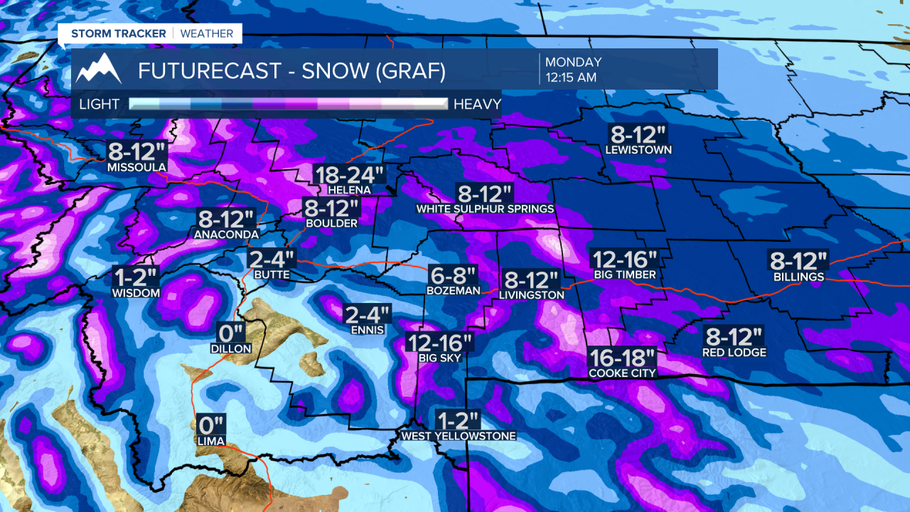
Once the snow comes to an end by early next week, deep cold Arctic air will sit over Montana all next week. Morning lows across the state will likely be below zero and wind chills at times could be dangerously cold.
The National Weather Service continues WINTER STORM WARNINGS along the Rocky mountain front southward to West Yellowstone and across central and southern counties.
Periods of moderate to heavy snow, areas of blowing snow, wind chills down to –20 to –30 below will produce hazardous to dangerous travel conditions.

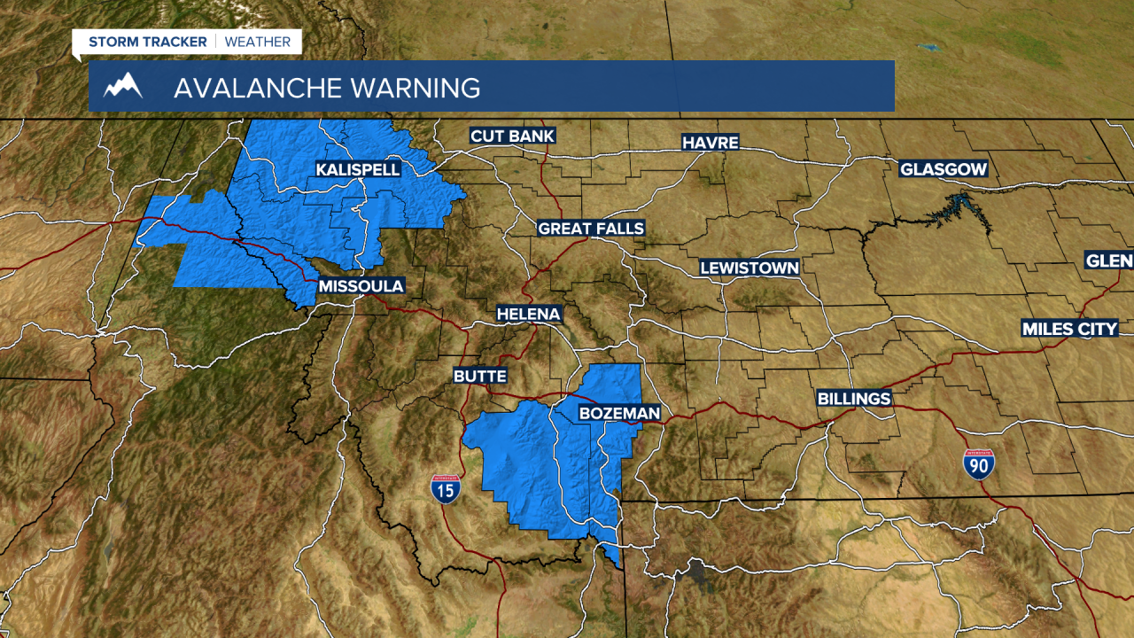
An AVALANCHE WARNING has also been issued for NW Montana and SW Montana, Madison and Gallatin counties this weekend.
Several feet of snow will overload a weak sublayer producing unstable avalanche conditions this weekend.
Natural and human caused avalanches are very likely and avalanche terrain and avalanche runout zones should be avoided. The danger is rated HIGH on all slopes. Also keep in mind that the overall weather pattern will be extreme in the backcountry which will make it difficult to impossible for search and rescue personnel to reach you if caught in an avalanche.
Forecast models continue to struggle with the overall intensity and duration of the Arctic air over SW Montana. Today’s model update shows the coldest morning lows will begin Monday and the coldest morning lows will be between Tuesday and Thursday mornings.
SUNDAY MORNING FEB.7

MONDAY MORNING FEB. 8

TUESDAY MORNING FEB . 9

WEDNESDAY MORNING FEB. 10

THURSDAY LOWS FEB. 11

FRIDAY LOWS FEB. 12

