


BOZEMAN – The quiet and mild pattern for the last 5 to 7 days will come to an end beginning Tuesday morning as an Alberta Clipper drops through Montana producing scattered snow and gusty winds with cooler temperatures.
Area of greatest concern for snow and blowing snow will along the Continental Divide eastward. Mountains and passes could see moderate snow at times Tuesday morning through Wednesday afternoon, but even lower valleys could see 1”-4” of snow.
The National Weather Service has issued a WINTER WEATHER ADVISORY from 3 am Tuesday to 3 pm Wednesday.
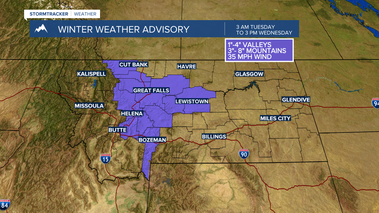
Snow accumulations around 1”-4” are possible with slightly higher amounts over mountains and passes. Look for locally windy conditions with gusts up to 35 mph and this could bring some blowing snow and lower visibility travel hazards.
Forecast for snow totals through early Thursday morning, this could change, has lower snow amounts west of the divide but around 2”-4” from Helena to Bozeman to Billings.

Plan on wintry travel conditions for Tuesday evening, Wednesday morning and Wednesday evening commutes.
The general trend is leaning toward a slight warm up by the weekend and mostly dry.
