BOZEMAN – A deep trough of Low-pressure is digging into central California with a slow moving surface Low at the bottom end of the trough. This is creating cooler than normal temperatures for Montana and watch for rotating bands of snow to impact most of Idaho, Wyoming, and southern Montana through Friday morning.
The area of greatest concern is along and south of I-90 in SW Montana. Scattered areas of snow, heavy at times, will produce wintry travel conditions with icy roads, snow covered roads, and lower visibility.
This system will spin out of the region by Friday afternoon allowing temperatures to moderate Friday into Saturday and most of us could see the lower 40s.
Another cold front will bring a quick shot of mostly snow Saturday evening and knock temperatures down heading into Sunday and early next week.
The National Weather Service continues WINTER WEATHER ADVISORIES across most of SW Montana through midnight Thursday. Periods of snow will impact travel conditions.
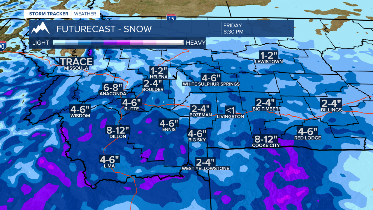
Snow accumulations will be highly varied see the graphic below.

The National Weather Service did issue a WINTER STORM WARNING for eastern Idaho including the Island Park, ID region now through noon on Friday.
Snow accumulations of 6”-9” is likely along US 20 and higher peaks could see well over a foot of snow.