


BOZEMAN – 1 pm Tuesday update: we are on track for increasing snow and wind as a cold front passes through the region this afternoon through Wednesday morning impacting travel at all levels.

The National Weather Service continues a WINTER STORM WARNING for SW Montana east of the divide above 6,500’ through 5 am Wednesday. Snow accumulations of 6”-12” is likely along with wind gusts up to or over 40 mph. This combination is producing snow, blowing snow, low visibility from West Yellowstone to Monida Pass up to Wisdom.
________________________________________________________________________________________________________________________________________________________________________________________

The National Weather Service continues a WINTER WEATHER ADVISORY through 5 am Wednesday for the rest of SW Montana not included in the winter storm warning. Snow accumulations, according to the NWS, valleys 1”-3” with mountains and passes 6”-12”. Wind gusts up to 40 mph are possible producing areas of blowing snow and lower visibility.
__________________________________________________________________________________________________________________________________________________________________
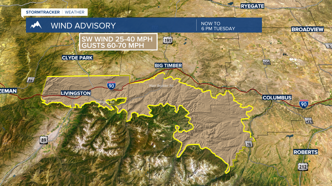
The National Weather Service also continues a WIND ADVISORY for the Livingston area through 6 pm Tuesday. Peak wind gusts up to 60 mph are possible. Although reduced wind gusts are likely tonight look for snow and gusty winds to impact travel from Livingston to Billings through Wednesday evening.
_____________________________________________________________________________________________________________________________________________________________
Possible snow accumulations through Wednesday morning. This is just one weather model snow forecast and it could be over estimating total inches, however, you should be prepared for light to moderate valley snow with the heaviest snow over mountain passes. Roads will become snow covered and icy, look for areas of blowing snow and lower visibility Tuesday afternoon through late morning Wednesday.

A very detailed weather forecast with timing and travel impacts can be found in the video above with Chief Meteorologist Mike Heard.
