


BOZEMAN – A deep trough of Low-pressure is now developing across the Pacific NW. This will continue to feed warm moist air into Montana tonight and Wednesday but at the same time colder Canadian air is digging into Montana from the North.
This combination will produce lower valley rain/snow into tonight but snow levels will fall down to the lower valley floor by Wednesday morning. This could produce very icy roads for your Wednesday morning and evening commutes.
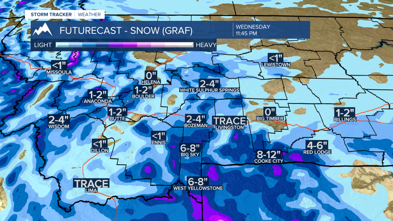
The National Weather Service has issued a WINTER WEATHER ADVISORY for most of SW Montana east of the divide from 10 pm Tuesday to 4 pm Wednesday.
Snow accumulations: 2”-5” for most valleys and mountain passes and over 7” for higher mountain ridgetops. Gusty winds to 35 mph are possible and could produce some blowing snow.

Although Butte to Missoula is not under the advisory look for similar results with around 1”-4” of snow and very icy roads by Wednesday morning.
Arctic air is still on track to dig into Montana beginning Thursday through most of next week. Central and eastern counties will have a higher probability of below zero temperatures this weekend. SW Montana will be trending colder than normal but forecast models are continuing to show most local temperatures should remain above zero this weekend. This could change.
Areas of light snow will continue as the colder air drops down into Montana late week and over the weekend. Wind chills at times for SW Montana could be below zero especially in the early morning hours.
I will have fresh updates on our local 7 and 10 day forecast temperatures tonight at 5:30 pm and 10 pm on KXLF and KBZK and on the CW at 9 pm.
