


BOZEMAN – A slow-moving Pacific storm system is moving from northern California to NE Montana over the next 36 hours.
Increasing wind, showers, stronger thunderstorms, and even a little higher mountain snow will impact SW Montana Wednesday evening through early Friday morning.
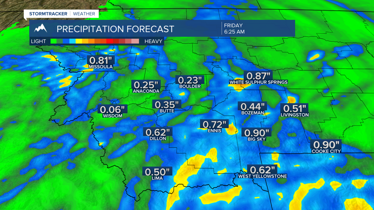
Rotating bands of showers and thunderstorms will bring periods of moderate to heavy rain over SW Montana. Most of us should see a quarter of an inch of rain, up to an inch or more.
Several inches of higher mountain snow are possible mostly Thursday evening into early Friday morning. If you are recreating in the backcountry be prepared for cold and wet weather conditions along with strong wind gusts.

After this storm exits the region Friday afternoon the overall pattern should fall back to a mostly dry and mild to warm pattern this weekend with above normal temperatures into early next week.
