


BOZEMAN – More unsettled weather for SW Montana through next week. Temperatures are running close to normal today but will fall below to well below normal by the middle of next week and that also means snow is in the forecast especially for mountain ranges.
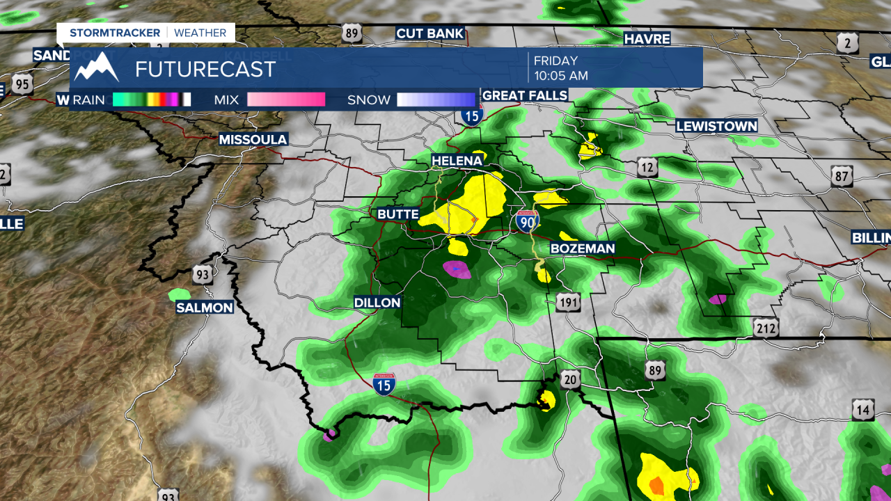
An upper-level Low will spin into SW Montana from Idaho Friday mid-morning. This should produce a fairly broad area of rain and embedded thunderstorms. After this Low ejects out of the region by early Friday afternoon, some renewed showers and thunderstorms will develop and continue up to around sunset.
There is only a slight chance for a few isolated showers and thunderstorms this weekend with near normal temperatures.
The next weather event will be a stronger cold front around Tuesday of next week. This will produce much cooler temperatures by Wednesday and some of our higher elevated valleys could see snow Wednesday or Thursday morning of next week and of course mountain snow is possible as well around the state.
