


Today's Forecast: Temperatures are expected to be relatively mild for your Monday as clouds try to roll into the area as a Pacific storm system is poised to bring mid-level moisture and overall mild air to the region through the afternoon and evening. A Winter Weather Advisory has been issued starting 11 AM Monday through 5 PM Tuesday for the Gallatin, Madison, and Centennial Mountain ranges. Valleys are expected to start seeing light flurries by the late afternoon and evening with minimal accumulation expected. Most of the snow should taper near dawn on Tuesday.
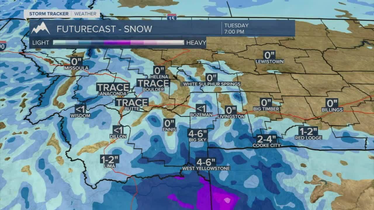
BOZEMAN: High: 35; Low: 24. Clouds will move into the area through the afternoon with light snow possible by the evening commute on Monday. Snow showers will pick up during the evening with less than 1” by early Tuesday morning.
BUTTE: High: 32; Low: 18. Spotty snow showers are possible during the late afternoon and evening with light accumulation expected by Tuesday morning. Accumulations are expected to be less than 1/2”.
DILLON: High: 33; Low: 19. Light snow by the afternoon with a slight breeze. Accumulation is expected to be minimal with the best snow potential expected for the evening.
WEST YELLOWSTONE: High: 33; Low: 19. Light snow picks up for the afternoon with total accumulation by early Tuesday expected to be between 4”-6”.
WARMER AND DRIER BY THE END OF THE WEEK
Our current weather pattern is turning warmer with plenty of Pacific moisture moving into the area. The best potential for snow will be Monday afternoon through early Tuesday before warmer air begins to move into the area. We are looking at above average temperatures topping out near 40° by the end of the week with very few snow chances through the weekend.
