BOZEMAN – Warming trend continued today and we should reach the peak by Friday with possible record highs. In fact, we could be in the lower 80s Friday afternoon.
The reason for the unseasonably warm weather is a combination of a High-pressure ridge and a Pacific trough. This will produce a stronger SW flow aloft and thus kick temperatures up into the 70s and 80s Friday.
A tightening pressure gradient between the ridge and the approaching trough will produce stronger surface wind gusts Friday. Locally, we could see gusts 30 to 50 mph Friday afternoon.
The combination of record heat, low humidity and gusty afternoon surface winds will create higher fire danger conditions over Montana Friday into Saturday. There will likely be some fire weather watches or warnings issued from the National Weather Service. Friday will NOT be a good day for Spring burning projects and possibly Saturday as well east of the divide.
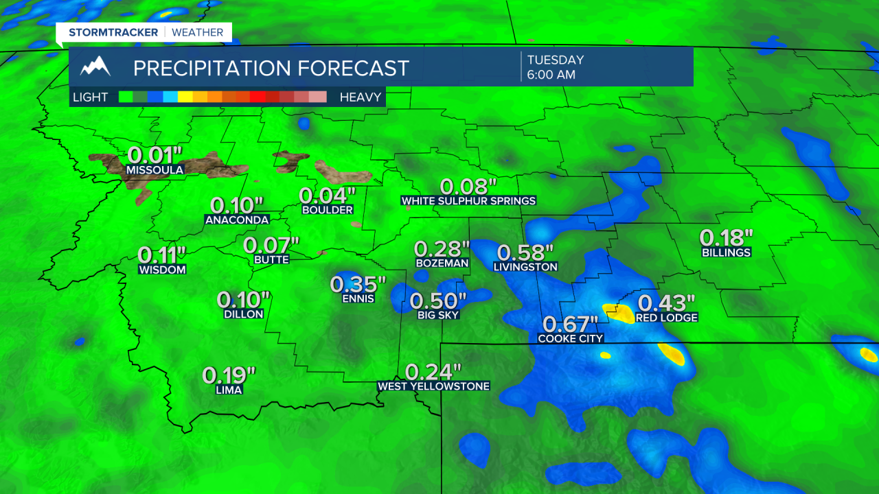
The Pacific trough will push a cold front through Montana Saturday into Sunday and knock temperatures back down into the 50s. The good news is this system will also bring an increasing chance for showers, isolated thunderstorms, and higher mountain snow Sunday into Monday.
ECMWF medium range precipitation forecast Sunday through Tuesday.