


BOZEMAN – Another Pacific cold front will pass through Montana Monday night through Tuesday morning. Ahead of this front we are mild and windy. Temperatures have warmed into the 40s and a few lower 50s but plan on colder temperatures to return starting Tuesday.
Tuesday morning commutes will likely be icy for most of SW Montana. Snow is likely for most mountain passes and some blowing snow overnight. Lower valleys could see a rain/snow mix with the front overnight and as temperatures fall below freezing area roadways could be very icy even down in the lower valleys.
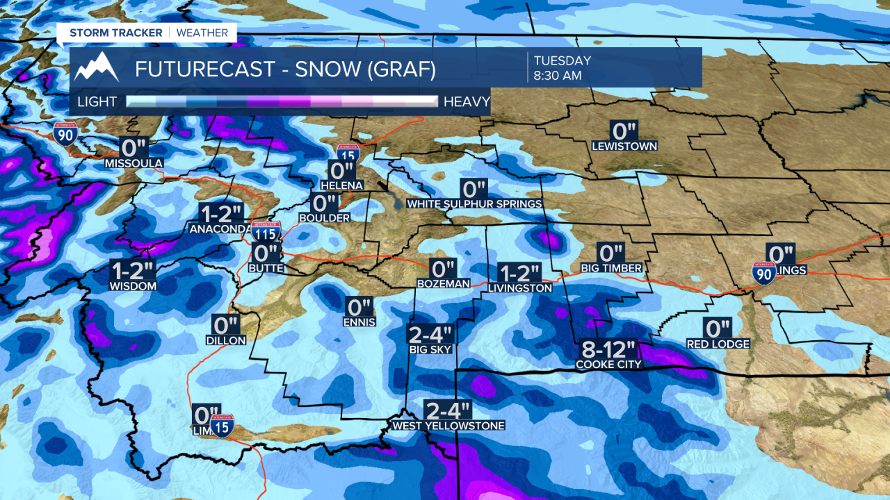
The National Weather Service has a WINTER WEATHER ADVISORY up for most of SW Montana both east and west of the divide with snow over area mountain passes.
Snow accumulations 3”-6” are possible at pass level and higher. Localized wind gusts 30 to 50 mph are possible along with the snow producing areas of blowing snow and reduced visibility.
Valley could see a rain snow mix and those wet roads could turn to ice just in time for the Tuesday morning commute.

The National Weather Service continues a HIGH WIND WARNING for most of central and northern Montana. Some warnings will expire around 10 pm tonight but the Livingston area the warning continues through Tuesday morning.
Peak wind gusts 60 to 80 mph have been reported Monday. Along the Rocky Mountain Front the high wind event is also producing blizzard conditions through this evening.

