


BOZEMAN - A high impact weather event is about to strike Montana. The combination of periods of heavy mountain snow and damaging peak wind gusts at all levels will develop with a powerful cold front Saturday.

Behind that cold front the door will be wide open for colder Arctic air to sink southward beginning Sunday with a sharp drop in temperatures by Monday along with periods of snow next week.
Travel conditions look horrible for Saturday but should be slightly better by Sunday.
The National Weather Service has numerous winter storm highlights and high wind highlights up across the region.
A WINTER WEATHER ADVISORY is up from 6 pm Friday to 6 pm Saturday for NW Beaverhead County, and mountain ranges in Madison and Gallatin Counties.
Snow accumulations of 1”-4” for higher elevated valleys with 4”-12”+ for higher elevations. Peak wind gusts 50 to 70 mph are possible. The combination of snow and powerful wind gusts will create hazardous conditions in the backcountry.

WINTER STORM WARNINGS are up now through 9 pm Saturday for Yellowstone National Park, Absaroka-Beartooth Range and over the Bitterroot and Saphire ranges.
10”-16” or more of snow is possible along with wind gusts 50 to 70 mph. This will create hazardous conditions in the backcountry.

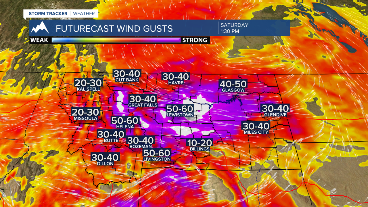
HIGH WIND WARNING is up over most of Montana Friday night through Saturday evening. For SW Montana the warning is from 3 am to 6 pm Saturday. During this time sustained surface wind of 30 to 50 mph is likely and peak gusts 50 to 70 mph are possible especially in high wind prone areas.
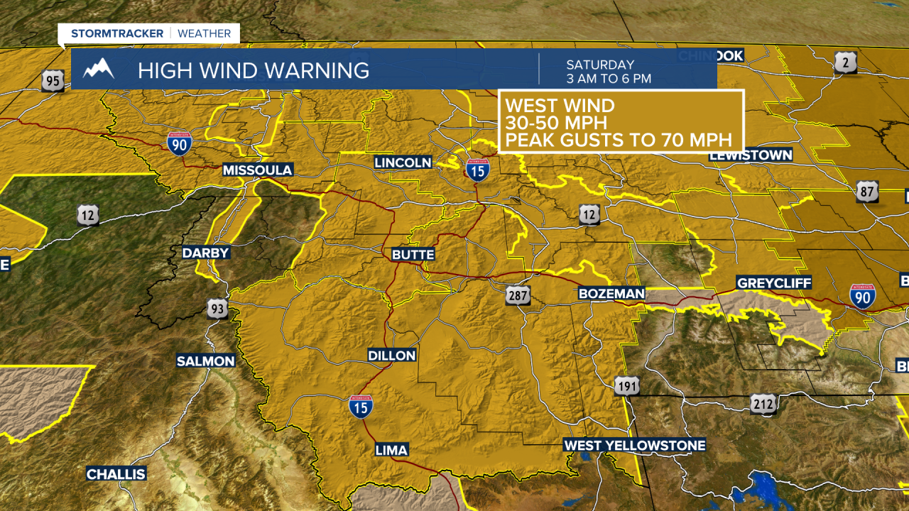
The strongest gusts should be between noon and 6 pm Saturday. If peak gusts exceed 60 mph property damage is possible along with power outages. This will be especially dangerous for high profile vehicles in crosswind areas on I-90 and I-15.
Please use common sense and extreme caution if you are taking a chance on traveling and hunting in the mountains Saturday.
