


BOZEMAN – A strong Pacific storm is just about to hit the west coast of the U.S. and bring heavy rain and higher mountain snow across the Pacific NW into western Montana.
Warm air will lift up ahead of the storm and could push high temperatures into the 40s and 50s Tuesday through Wednesday.

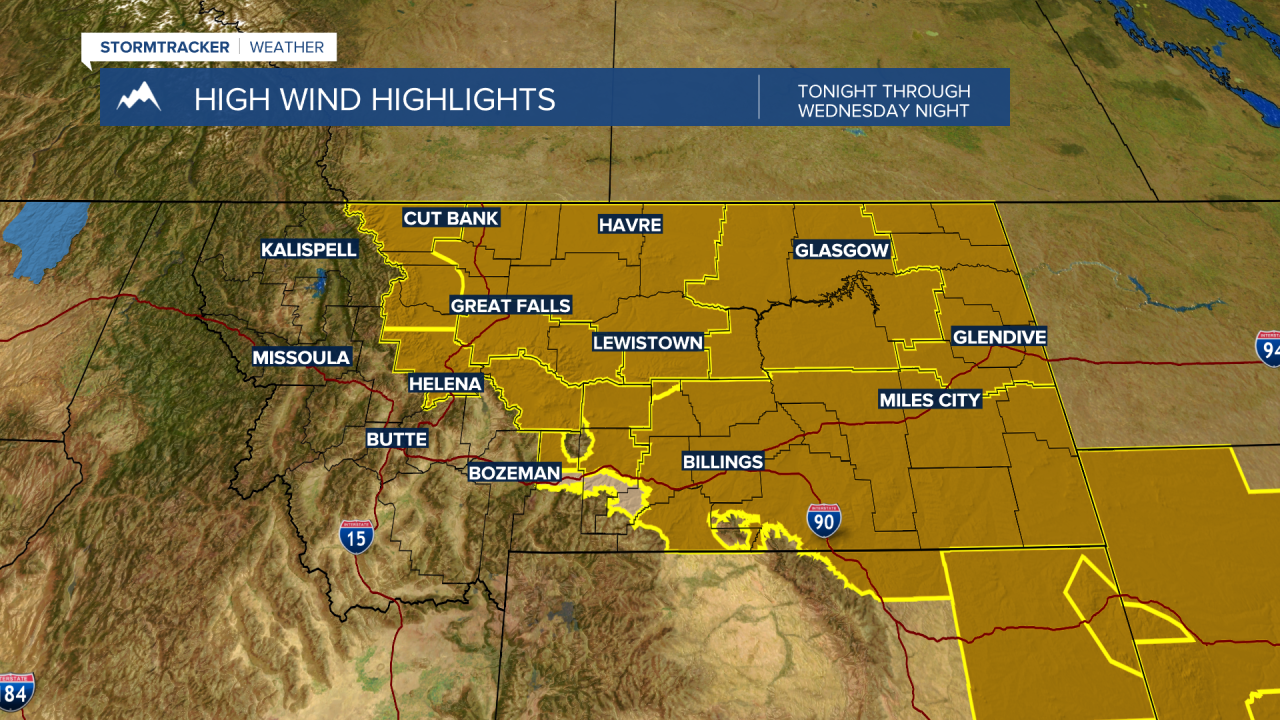
Some of the warmest temperatures will be a direct result of very strong surface winds east of the divide. There are high wind Watches and Advisories up beginning Monday night through Thursday night. Some of the strongest gusts will come Wednesday into Thursday and for high wind prone areas along the Rocky Mountain front and adjacent plains along with the Upper Yellowstone region peak wind gusts over 60 mph are likely.
Upslope areas along the Montana-Idaho state line could see moderate to heavy wet snow impacting travel over Lookout Pass on I-90 Tuesday through Thursday. Heavy snow is also possible around Glacier National Park, the west side of the Rocky Mountain front, and a secondary area of moderate to heavy snow is possible across Eastern Idaho into Yellowstone National Park.
Mountain ranges across SW Montana will see periods of snow and above 7,000’ there could be locally heavy wet snow at times. But this storm system has a warm core so lower levels could see rain and gusty winds and a rain/snow mix for some of our local mountain passes.

The combination of warm wind, above normal temperatures, and rain could lead to rapid snowmelt for lower valleys like Bozeman and runoff could become an issue so watch for possible ponding and wet roads Wednesday into Thursday.
