


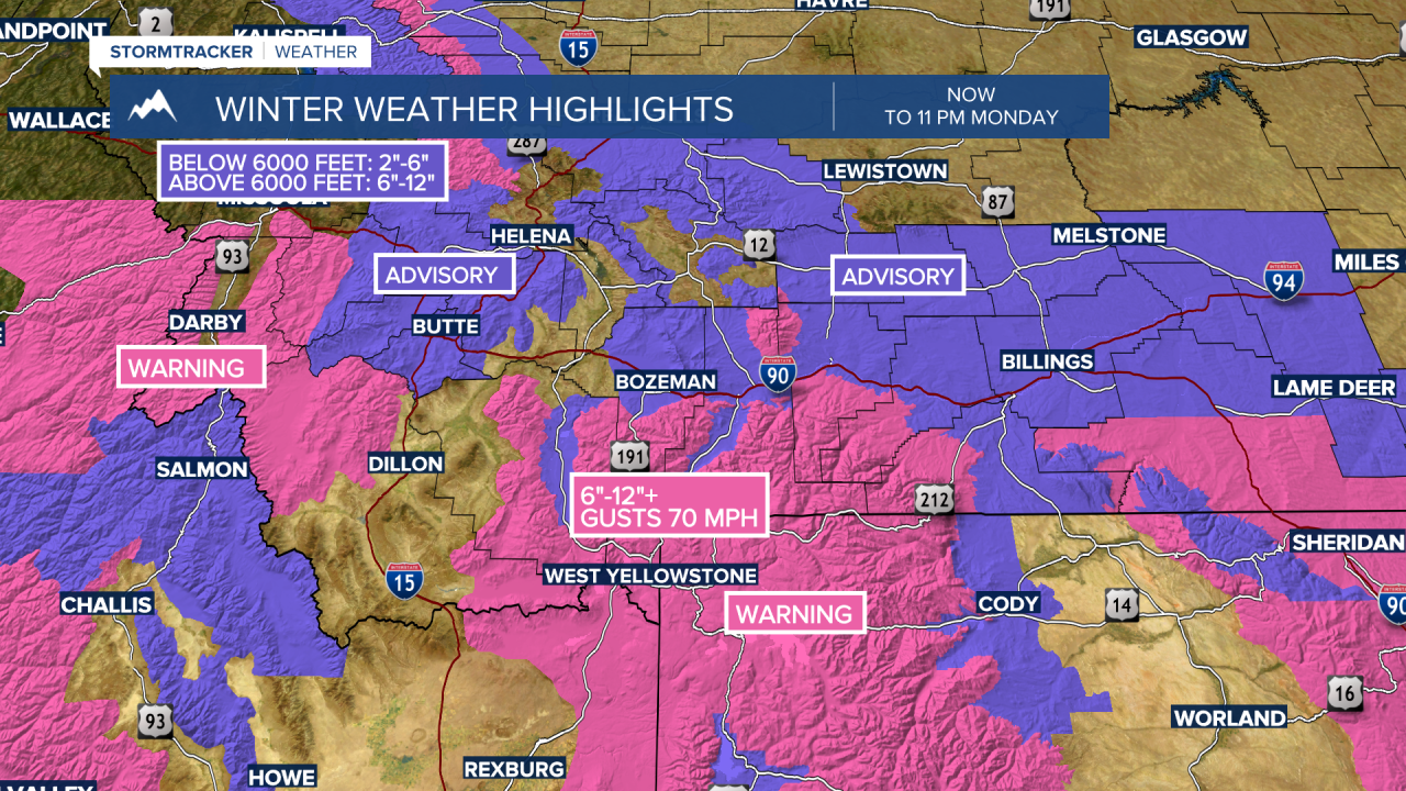
BOZEMAN – Flash Freeze ALERT! An Arctic cold front is passing through Monday afternoon producing periods of moderate to heavy snow, wind gusts 30 to 70 mph and rapidly falling temperatures.
All the factors listed above will produce hazardous to dangerous travel conditions. The greatest impact will be wet roadways flash freezing creating extremely icy road conditions. Snow and blowing snow will continue up to midnight and turn more scattered overnight.
There are numerous winter weather highlights up for snow and blowing along with high wind highlights for gusts up to or over 60 mph. Most of these severe winter weather statements will expire around midnight Monday.

Temperatures will be turning colder tonight into Tuesday, but a slow warming trend begins Wednesday, and we could be back above normal by Thursday.
The next weather maker with more snow and cold is coming by the end of the week into the upcoming weekend.
