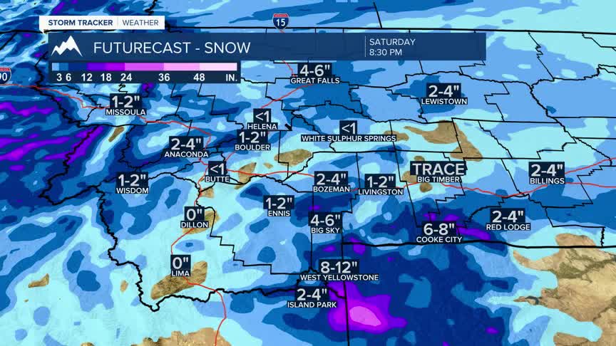


BOZEMAN – A pattern change arrives Friday afternoon as a stronger NW flow aloft develops producing increasing snow,windand much colder temperatures.
Snow and wind will be the main concern Friday afternoon through Saturday afternoon with possible snow squalls. Short intense periods of snow and wind can create difficult to hazardous travel conditions.
There are winter weather highlights up for SW Montana Friday into Saturday for snow and wind.
As this storm system moves out and skies clear look for much colder temperatures by Sunday morning. In fact, there could be lows slightly below zero by the end of the weekend.
This cold snap should be short-lived with a gradual warming trend beginning on Monday and back to above normal temperatures by the middle of next week.
