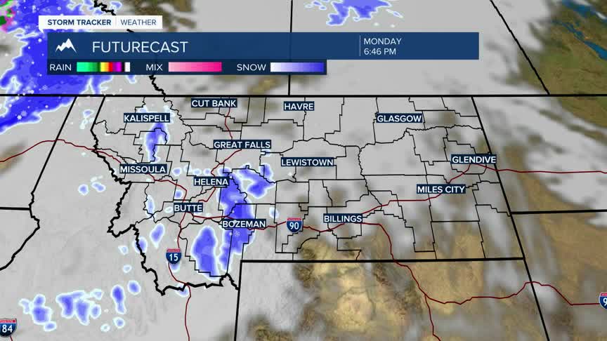


BOZEMAN – A NW flow aloft will pave the way for several Pacific storms to pass through the region producing off and on rounds of snow.
The first system arrives Monday evening and could linger through Wednesday morning. Scattered off and on snow will develop over most of Montana, but western, central and SW Montana has the better chance of accumulating snow at all levels.
There is a WINTER WEATHER ADVISORY up for SW Montana west of the divide from 8 pm Monday to 5 pm Tuesday. Total snow accumulations of 1”-3” are possible for lower valleys and mountains and passes 3”-5” is possible. This includes Homestake Pass, MacDonald Pass, Wisdom to Wise River, and Georgetown Lake.
A WINTER WEATHER ADVISORY is also up for Madison and Gallatin Counties from 11 pm Monday to 5 am Wednesday. Lower valleys could see 2”-6” with 6”-11” formountains and passes including Bozeman Pass. Locally windy conditions could also produce areas of blowing snow with gusts up to 40 mph.
This system should exit the region by late Wednesday morning. The next weather maker begins to move in by Thursday afternoon, and this storm system could linger through Saturday afternoon.
Valley and mountain snow are possible with this second storm system later this week.
