


BOZEMAN – More snow will impact Montana Thursday through Saturday. A classic over-running pattern as cold Arctic air digs in at the surface and warm moist pacific air is forced over the top of the cold air will lead to steady light snow.
Mountains and passes across SW Montana will see periods of moderate to heavy snow beginning Thursday evening. Also watch for locally windy conditions which will produce areas of blowing snow and below zero wind chills.
By the weekend, deep Arctic air will dig into northern and central Montana. Below zero air temperatures are likely for many areas east of the divide and wind chills could be extremely cold at times. SW Montana is not expected to see the extreme cold but temperatures will be well below normal and wind chills could be below zero.
The National Weather Service has a WINTER STORM WATCH up along the Rocky mountain front down into West Yellowstone from Thursday evening through Saturday morning.
Snow accumulations: mountains and passes 6”-12” and lower valleys 1”-6”. Gusty winds will produce areas of blowing snow and wind chills below zero.

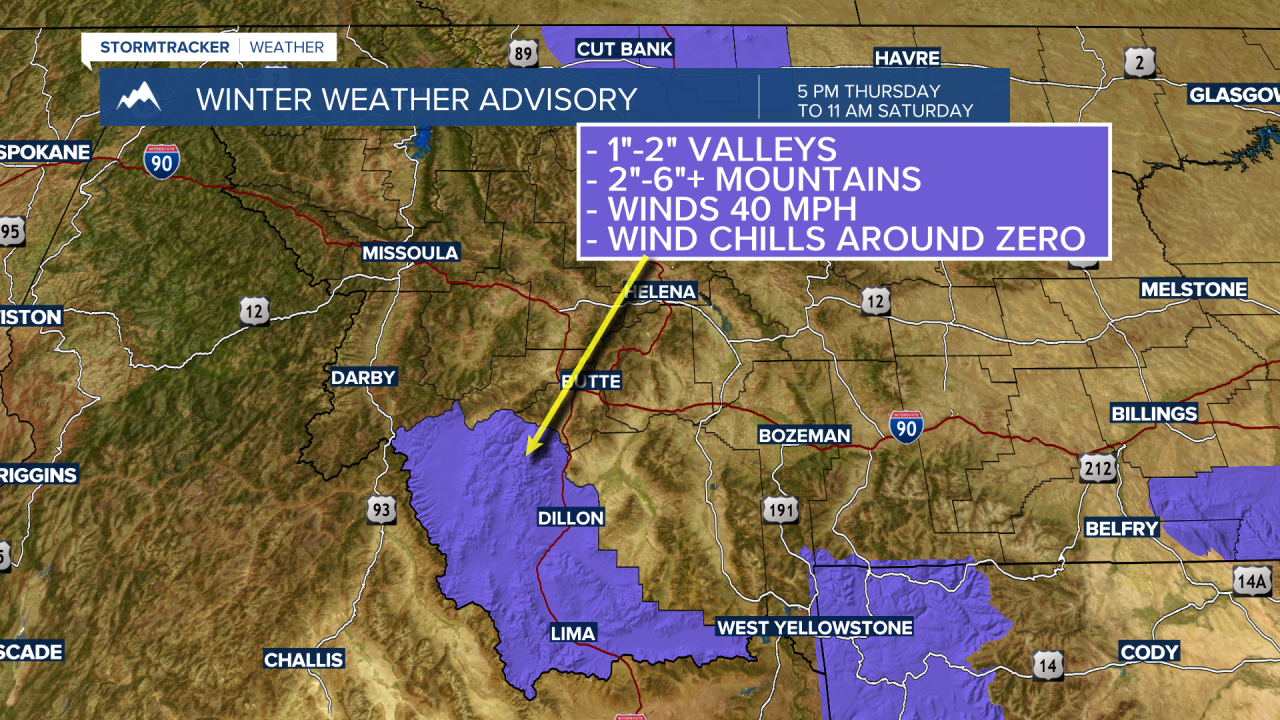
The National Weather Service has issued a WINTER WEATHER ADVISORY for Beaverhead county from 5 pm Thursday to 11 am Saturday.
Snow accumulations: 1”-2” for lower valleys and 2”-6” for mountains and passes. Gusty winds could produce wind chills around zero.

As the snow comes to an end Saturday look for very cold temperatures for the rest of the weekend into early next week.
The following are forecast lows for Saturday, Sunday, and Monday. The National Weather Service forecast temperatures are not as cold as shown in the graphics. The three graphics below are just one model estimated temperatures.


