BOZEMAN – The overall weather pattern will remain locked into place through early next week. A strong westerly flow aloft will keep temperatures above to well above normal with the potential for numerous record highs Wednesday and Thursday.
An atmospheric river of warm sub-tropical moisture just North of Hawaii is following the Polar Jet stream up into the Pacific NW and Western Canada. This pattern will keep the potential for flooding along the coast and rain or snow up against the Montana & Idaho state line especially west of Missoula.

At times there could be some light rain or snow passing through SW Montana but most forecast models have a dry solution over our region through the end of the week.
Forecast highs are once again up around 60 degrees Wednesday and Thursday. This will put most reporting stations near record high levels. On average, most of the region should see daily highs in the upper 20s to the mid 30s.
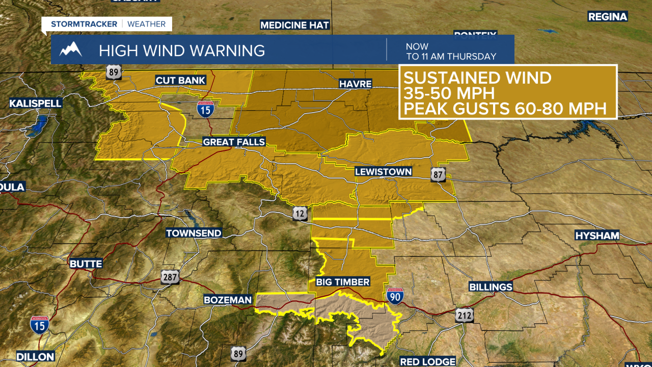
Other weather-related issues with this pattern will be wind. Along the Rocky Mountain front down into the Upper Yellowstone region, wind gusts over 70 mph are possible and this will create hazardous travel conditions with areas of blowing dust, possible tree damage and power outages, and dangerous conditions for high profile vehicles especially in the cross-wind areas.
The National Weather Service has issued a WIND ADVISORY for the Livingston area now through 11 am Thursday. Sustained West to SW surface wind 30 to 50 mph is likely with peak gusts at times up to or over 70 mph.

The National Weather Service has a HIGH WIND WARNING up for most of central and northern Montana counties through Thursday morning. This region could also see peak wind gusts up to or over 70 mph and property damage is possible.