


Today's Forecast:
Today will be the last mild day for a while across southwest Montana. Expect a mix of sunshine and increasing clouds with temperatures climbing well above normal this afternoon. Rain develops tonight ahead of a strong cold front that will bring much colder temperatures and lowering snow levels on Friday.
BOZEMAN:
High: 68; Low: 45.
Mostly sunny this morning with increasing clouds this afternoon and evening. Winds remain fairly light from the south to southeast. Rain develops late tonight and continues into Friday as colder air moves into the Gallatin Valley.
BUTTE:
High: 67; Low: 43.
Partly sunny skies and mild temperatures continue through much of the day. A slight chance of rain develops late this afternoon before steadier rain arrives overnight. Much colder weather follows on Friday.
DILLON:
High: 67; Low: 45.
A mix of sun and clouds with mild conditions. South winds may become a little breezy this afternoon. Rain chances increase tonight as the approaching storm system draws closer.
WEST YELLOWSTONE:
High: 62; Low: 38.
Clouds increase through the day with rain developing late this afternoon and becoming widespread tonight. Colder air arrives Friday, allowing rain to mix with and change to snow across the higher terrain.
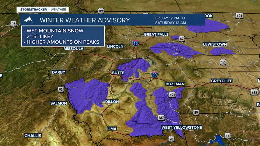
Winter Weather Advisory Friday; Much Colder Weekend Ahead
A strong autumn storm will move through southwest Montana Friday. A Winter Weather Advisory is in effect from Noon Friday through Midnight Friday Night for the Gallatin and Madison County Mountains and Centennial Mountains. Snow is expected to develop Friday afternoon as temperatures fall, with up to 8 inches of accumulation possible during the day Friday in the mountains, followed by additional moderate accumulations Friday night. Mountain passes could become snow-covered with reduced visibility and gusty winds.
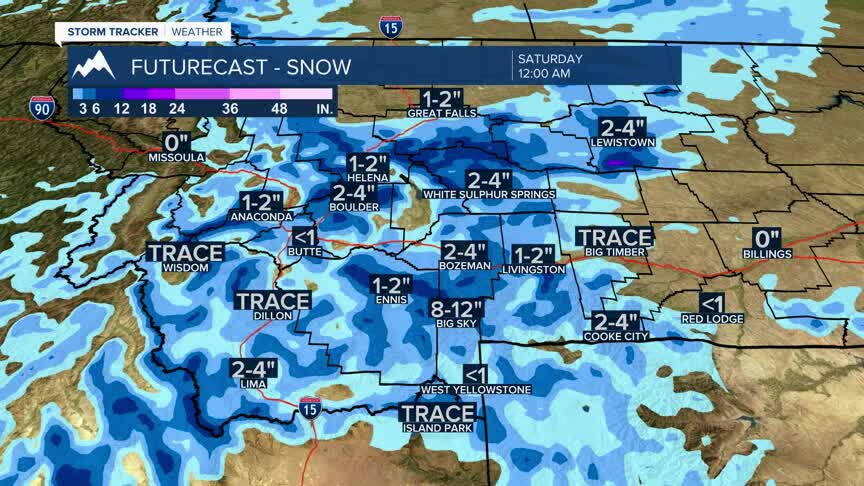
Snow levels will fall rapidly Friday, potentially reaching some valley floors by evening. Most lower elevations should see primarily rain before any late-day changeover, while the heaviest snowfall remains focused above 4,500 feet. Temperatures turn sharply colder behind the front, with dry but chilly weather returning for the weekend.
