


BOZEMAN – The greatest weather hazard Wednesday is high winds in the Livingston area and freezing rain west of Deer Lodge.
A mild SW flow is helping temperatures warm above normal today and with the help of stronger surface winds, valley inversions have been scrubbed out of the lower valleys.
Temperatures are running between 10 to 25 degrees warmer mid-day Wednesday compared to the same time Tuesday afternoon.

The next weather maker is along the Pacific NW coast and lifting over a High-pressure ridge. Most of this storm is headed into Canada with more rain or snow bumping up against the MT/ID state line impacting travel on I-90 west of Missoula tonight into tomorrow.
The ridge pattern will weaken enough to allow a cold front to drop through the state Thursday evening producing a quick shot of snow by Friday morning across SW Montana. This could produce some minor impacts for your Friday morning commute but improving travel conditions should return by Friday afternoon.
In the short term, the National Weather Service continues HIGH WIND WARNINGS and a WIND ADVISORY in the Livingston area through this evening and possibly continued strong wind gusts into Thursday morning.
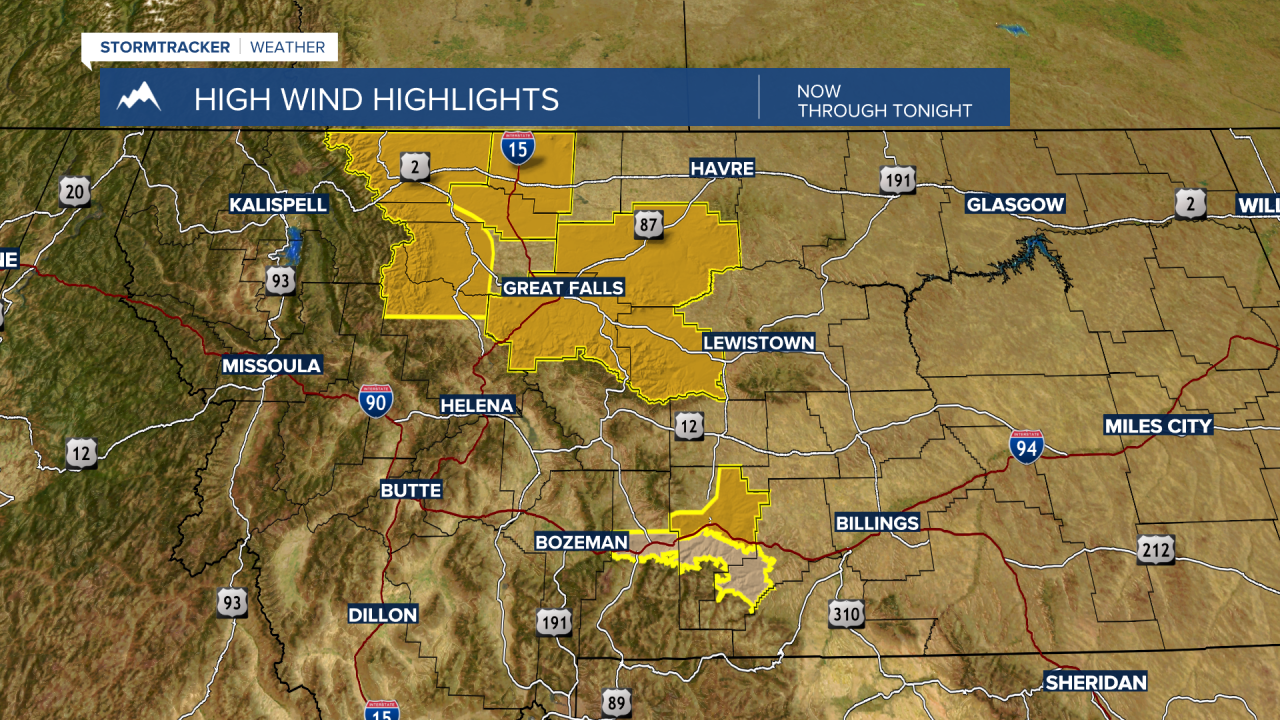
Peak gusts in the areas highlighted in the graphic could be between 60 to 70 mph.

